Upper Sandusky geodata
Upper Sandusky (Ohio) is a seat of a second-order administrative division; located in United States in America/New_York (GMT-4) time zone. With population of 6,527 people, there are 6094 cities with bigger population in this country. Compared to other cities in United States, 63.7% of cities are located further ↓South; 61.2% of cities are located further ←West and 64.5% of cities have lower elevation than Upper Sandusky. Note1


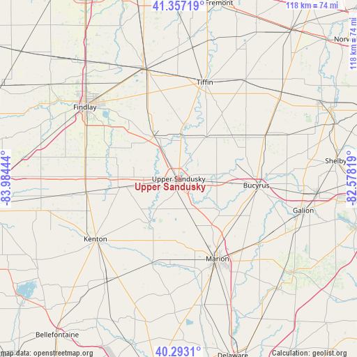
Upper Sandusky GPS coordinates[2]
40° 49' 38.208" North, 83° 16' 52.716" West
| Map corner | latitude | longitude |
|---|---|---|
| Upper-left | 41.35719°, | -83.98444° |
| Center: | 40.82728°, | -83.28131° |
| Lower-right: | 40.2931°, | -82.57819° |
| Map W x H: | 118.3×118.3 km | = 73.5×73.5mi |
| max Lat: | 71.29058° ⇑36.3% North |
| Upper Sandusky: | 40.82728° |
| min Lat: | ⇓63.7% South 19.06759° |
| min Long | Upper Sandusky | max Long |
| -171.73463° | -83.28131° | -66.98998° |
| W 61.2%⇐ | ⇒38.8% E |
Elevation
Elevation of Upper Sandusky is 260 m = 853 ft, and this is 34.8 m = 114 ft below average elevation for this country.
| Max E: |
3189 m = 10463 ft | 35.5% |
| Avg. | 294.8 m = 967 ft | |
| Upper Sandusky | 260 m = 853 ft | |
Min E: |
-60 m = -197 ft | 64.5% |
See also: United States elevation on elevation.city.
Geographical zone
Upper Sandusky is located in North temperate zone (between Tropic of Cancer and the Arctic Circle). Distance of this Northern Tropic circle is 1933.6 km =1201.5 mi to South.| Distance of | km | miles | from Upper Sandusky |
|---|---|---|---|
| North Pole | 5467.5 | 3397.3 | to North |
| Arctic Circle | 2861.6 | 1778.1 | to North |
| Tropic Cancer | 1933.6 | 1201.5 | to South |
| Equator | 4539.6 | 2820.8 | to South |


Nearby cities:
15 places around Upper Sandusky: (largest is in red/bold)
• Arcadia
37 km =23 mi,  327°
327°
• Arlington
31.9 km =19.8 mi,  283°
283°
• Bloomville
33.5 km =20.8 mi,  41°
41°
• Bucyrus
25.8 km =16 mi,  94°
94°
• Caledonia
33.8 km =21 mi,  128°
128°
• Carey
16.3 km =10.1 mi, 328°
• Dunkirk
30.8 km =19.1 mi,  262°
262°
• Forest
19.5 km =12.1 mi, 261°
• Kenton
34.2 km =21.3 mi,  234°
234°
• La Rue
29.2 km =18.1 mi,  197°
197°
• Marion
29.5 km =18.3 mi,  154°
154°
• Mount Victory
38.3 km =23.8 mi,  211°
211°
• Nevada
12.7 km =7.9 mi, 94°
• Sycamore
16.5 km =10.3 mi,  34°
34°
• Tiffin
33.1 km =20.6 mi,  15°
15°
Sources, notices
• [Note1] Compared only with cities in United States existing in our database
• [Src1] Map data: © OpenStreetMap contributors (CC-BY-SA)
• [Src2] Other city data from geonames.org with taken over terms of usage.
• [Src3] Geographical zone / Annual Mean Temperature by Robert A. Rohde @ Wikipedia
