Jessup geodata
Jessup (Pennsylvania) is a populated place; located in United States in America/New_York (GMT-4) time zone. With population of 4,495 people, there are 7646 cities with bigger population in this country. Compared to other cities in United States, 70.5% of cities are located further ↓South; 85.4% of cities are located further ←West and 72% of cities have lower elevation than Jessup. Note1
Administrative division(s):
- Level 1: Pennsylvania
- Level 2: Lackawanna County
- Level 3: Borough of Jessup


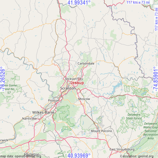
Jessup GPS coordinates[2]
41° 28' 7.284" North, 75° 33' 43.668" West
| Map corner | latitude | longitude |
|---|---|---|
| Upper-left | 41.99341°, | -76.26526° |
| Center: | 41.46869°, | -75.56213° |
| Lower-right: | 40.93969°, | -74.85901° |
| Map W x H: | 117.2×117.2 km | = 72.8×72.8mi |
| max Lat: | 71.29058° ⇑29.5% North |
| Jessup: | 41.46869° |
| min Lat: | ⇓70.5% South 19.06759° |
| min Long | Jessup | max Long |
| -171.73463° | -75.56213° | -66.98998° |
| W 85.4%⇐ | ⇒14.6% E |
Elevation
Elevation of Jessup is 296 m = 971 ft, and this is 1.2 m = 4 ft above average elevation for this country.
| Max E: |
3189 m = 10463 ft | 28% |
| Jessup | 296 m 971 ft | |
| Avg. | 294.8 m = 967 ft | |
Min E: |
-60 m = -197 ft | 72% |
See also: United States elevation on elevation.city.
Geographical zone
Jessup is located in North temperate zone (between Tropic of Cancer and the Arctic Circle). Distance of this Northern Tropic circle is 2005 km =1245.8 mi to South.| Distance of | km | miles | from Jessup |
|---|---|---|---|
| North Pole | 5396.2 | 3353 | to North |
| Arctic Circle | 2790.3 | 1733.8 | to North |
| Tropic Cancer | 2005 | 1245.8 | to South |
| Equator | 4610.9 | 2865.1 | to South |


Nearby cities:
15 places around Jessup: (largest is in red/bold)
• Archbald
3.6 km =2.2 mi,  35°
35°
• Blakely
3 km =1.9 mi,  296°
296°
• Carbondale
12.7 km =7.9 mi,  23°
23°
• Chinchilla
9.6 km =6 mi,  274°
274°
• Clarks Green
11.8 km =7.3 mi,  283°
283°
• Clarks Summit
12.4 km =7.7 mi, 280°
• Dickson City
3.8 km =2.4 mi, 274°
• Dunmore
8 km =5 mi,  227°
227°
• Jermyn
7.1 km =4.4 mi,  11°
11°
• Mayfield
8 km =5 mi, 15°
• Mount Cobb
8.4 km =5.2 mi,  136°
136°
• Olyphant
3.4 km =2.1 mi, 269°
• Scranton
10.8 km =6.7 mi, 232°
• Throop
4.6 km =2.9 mi,  245°
245°
• Waverly
13.6 km =8.5 mi, 298°
Sources, notices
• [Note1] Compared only with cities in United States existing in our database
• [Src1] Map data: © OpenStreetMap contributors (CC-BY-SA)
• [Src2] Other city data from geonames.org with taken over terms of usage.
• [Src3] Geographical zone / Annual Mean Temperature by Robert A. Rohde @ Wikipedia
