Mount Cobb geodata
Mount Cobb (Pennsylvania) is a populated place; located in United States in America/New_York (GMT-4) time zone. With population of 1,799 people, there are 12541 cities with bigger population in this country. Compared to other cities in United States, 69.9% of cities are located further ↓South; 85.7% of cities are located further ←West and 88% of cities have lower elevation than Mount Cobb. Note1
Administrative division(s):
- Level 1: Pennsylvania
- Level 2: Lackawanna County
- Level 3: Township of Jefferson


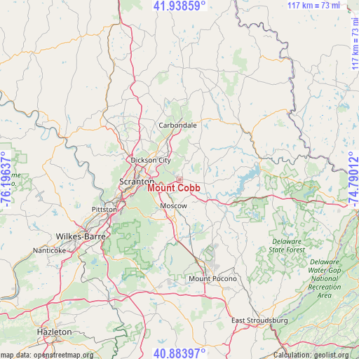
Mount Cobb GPS coordinates[2]
41° 24' 48.312" North, 75° 29' 35.664" West
| Map corner | latitude | longitude |
|---|---|---|
| Upper-left | 41.93859°, | -76.19637° |
| Center: | 41.41342°, | -75.49324° |
| Lower-right: | 40.88397°, | -74.79012° |
| Map W x H: | 117.3×117.3 km | = 72.9×72.9mi |
| max Lat: | 71.29058° ⇑30.1% North |
| Mount Cobb: | 41.41342° |
| min Lat: | ⇓69.9% South 19.06759° |
| min Long | Mount Cobb | max Long |
| -171.73463° | -75.49324° | -66.98998° |
| W 85.7%⇐ | ⇒14.3% E |
Elevation
Elevation of Mount Cobb is 507 m = 1663 ft, and this is 212.2 m = 696 ft above average elevation for this country.
| Max E: |
3189 m = 10463 ft | 12% |
| Mount Cobb | 507 m 1663 ft | |
| Avg. | 294.8 m = 967 ft | |
Min E: |
-60 m = -197 ft | 88% |
See also: United States elevation on elevation.city.
Geographical zone
Mount Cobb is located in North temperate zone (between Tropic of Cancer and the Arctic Circle). Distance of this Northern Tropic circle is 1998.8 km =1242 mi to South.| Distance of | km | miles | from Mount Cobb |
|---|---|---|---|
| North Pole | 5402.3 | 3356.8 | to North |
| Arctic Circle | 2796.4 | 1737.6 | to North |
| Tropic Cancer | 1998.8 | 1242 | to South |
| Equator | 4604.7 | 2861.2 | to South |


Nearby cities:
15 places around Mount Cobb: (largest is in red/bold)
• Archbald
9.8 km =6.1 mi,  338°
338°
• Big Bass Lake
17.8 km =11.1 mi,  175°
175°
• Blakely
11.3 km =7 mi,  311°
311°
• Chinchilla
16.8 km =10.4 mi,  294°
294°
• Dickson City
11.5 km =7.1 mi,  304°
304°
• Dunmore
11.6 km =7.2 mi,  273°
273°
• Jermyn
13.8 km =8.6 mi, 341°
• Jessup
8.4 km =5.2 mi,  316°
316°
• Mayfield
14.3 km =8.9 mi,  345°
345°
• Moscow
8.8 km =5.5 mi,  193°
193°
• Olyphant
11 km =6.8 mi, 303°
• Pocono Springs
16.9 km =10.5 mi,  156°
156°
• Scranton
14.3 km =8.9 mi, 268°
• The Hideout
11.8 km =7.3 mi,  82°
82°
• Throop
10.8 km =6.7 mi, 293°
Sources, notices
• [Note1] Compared only with cities in United States existing in our database
• [Src1] Map data: © OpenStreetMap contributors (CC-BY-SA)
• [Src2] Other city data from geonames.org with taken over terms of usage.
• [Src3] Geographical zone / Annual Mean Temperature by Robert A. Rohde @ Wikipedia
