Sellersville geodata
Sellersville (Pennsylvania) is a populated place; located in United States in America/New_York (GMT-4) time zone. With population of 4,212 people, there are 7967 cities with bigger population in this country. Compared to other cities in United States, 57.3% of cities are located further ↓South; 86.3% of cities are located further ←West and 68.8% of cities have higher elevation than Sellersville. Note1
Administrative division(s):
- Level 1: Pennsylvania
- Level 2: Bucks County
- Level 3: Borough of Sellersville


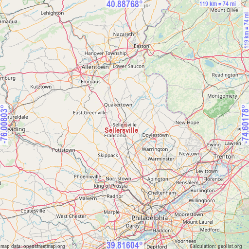
Sellersville GPS coordinates[2]
40° 21' 14.364" North, 75° 18' 17.64" West
| Map corner | latitude | longitude |
|---|---|---|
| Upper-left | 40.88768°, | -76.00803° |
| Center: | 40.35399°, | -75.3049° |
| Lower-right: | 39.81604°, | -74.60178° |
| Map W x H: | 119.2×119.2 km | = 74.1×74.1mi |
| max Lat: | 71.29058° ⇑42.7% North |
| Sellersville: | 40.35399° |
| min Lat: | ⇓57.3% South 19.06759° |
| min Long | Sellersville | max Long |
| -171.73463° | -75.3049° | -66.98998° |
| W 86.3%⇐ | ⇒13.7% E |
Elevation
Elevation of Sellersville is 108 m = 354 ft, and this is 186.8 m = 613 ft below average elevation for this country.
| Max E: |
3189 m = 10463 ft | 68.8% |
| Avg. | 294.8 m = 967 ft | |
| Sellersville | 108 m = 354 ft | |
Min E: |
-60 m = -197 ft | 31.2% |
See also: United States elevation on elevation.city.
Geographical zone
Sellersville is located in North temperate zone (between Tropic of Cancer and the Arctic Circle). Distance of this Northern Tropic circle is 1881 km =1168.8 mi to South.| Distance of | km | miles | from Sellersville |
|---|---|---|---|
| North Pole | 5520.1 | 3430 | to North |
| Arctic Circle | 2914.2 | 1810.8 | to North |
| Tropic Cancer | 1881 | 1168.8 | to South |
| Equator | 4486.9 | 2788 | to South |


Nearby cities:
15 places around Sellersville: (largest is in red/bold)
• Brittany Farms-Highlands
12.2 km =7.6 mi,  140°
140°
• Chalfont
10.9 km =6.8 mi,  131°
131°
• Dublin
9 km =5.6 mi,  77°
77°
• Harleysville
10.8 km =6.7 mi,  220°
220°
• Hatfield
8.3 km =5.2 mi,  176°
176°
• Kulpsville
12.6 km =7.8 mi,  192°
192°
• Lansdale
12.6 km =7.8 mi,  171°
171°
• Milford Square
12.2 km =7.6 mi,  319°
319°
• New Britain
12.2 km =7.6 mi,  120°
120°
• Perkasie
2.3 km =1.4 mi,  27°
27°
• Quakertown
10.2 km =6.3 mi,  342°
342°
• Silverdale
3 km =1.9 mi,  103°
103°
• Souderton
5 km =3.1 mi,  200°
200°
• Telford
4.1 km =2.5 mi,  208°
208°
• Trumbauersville
8.8 km =5.5 mi, 315°
Sources, notices
• [Note1] Compared only with cities in United States existing in our database
• [Src1] Map data: © OpenStreetMap contributors (CC-BY-SA)
• [Src2] Other city data from geonames.org with taken over terms of usage.
• [Src3] Geographical zone / Annual Mean Temperature by Robert A. Rohde @ Wikipedia
