Peach Springs geodata
Peach Springs (Arizona) is a populated place; located in United States in America/Phoenix (GMT-7) time zone. With population of 1,090 people, there are 15733 cities with bigger population in this country. Compared to other cities in United States, 72.5% of cities are located further ↑North; 88.3% of cities are located further →East and 96.4% of cities have lower elevation than Peach Springs. Note1


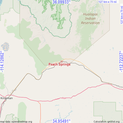
Peach Springs GPS coordinates[2]
35° 31' 44.976" North, 113° 25' 31.764" West
| Map corner | latitude | longitude |
|---|---|---|
| Upper-left | 36.09933°, | -114.12862° |
| Center: | 35.52916°, | -113.42549° |
| Lower-right: | 34.95491°, | -112.72237° |
| Map W x H: | 127.2×127.2 km | = 79×79mi |
| max Lat: | 71.29058° ⇑72.5% North |
| Peach Springs: | 35.52916° |
| min Lat: | ⇓27.5% South 19.06759° |
| min Long | Peach Springs | max Long |
| -171.73463° | -113.42549° | -66.98998° |
| W 11.7%⇐ | ⇒88.3% E |
Elevation
Elevation of Peach Springs is 1466 m = 4810 ft, and this is 1171.2 m = 3843 ft above average elevation for this country.
| Max E: |
3189 m = 10463 ft | 3.6% |
| Peach Springs | 1466 m 4810 ft | |
| Avg. | 294.8 m = 967 ft | |
Min E: |
-60 m = -197 ft | 96.4% |
See also: United States elevation on elevation.city.
Geographical zone
Peach Springs is located in North temperate zone (between Tropic of Cancer and the Arctic Circle). Distance of this Northern Tropic circle is 1344.6 km =835.5 mi to South.| Distance of | km | miles | from Peach Springs |
|---|---|---|---|
| North Pole | 6056.6 | 3763.4 | to North |
| Arctic Circle | 3450.7 | 2144.2 | to North |
| Tropic Cancer | 1344.6 | 835.5 | to South |
| Equator | 3950.5 | 2454.7 | to South |


Nearby cities:
15 places around Peach Springs: (largest is in red/bold)
• Bagdad
107.3 km =66.7 mi,  169°
169°
• Bullhead City
112 km =69.6 mi,  247°
247°
• Chino Valley
123.2 km =76.6 mi,  134°
134°
• Dolan Springs
77 km =47.8 mi,  275°
275°
• Golden Valley
79.9 km =49.6 mi,  244°
244°
• Kingman
68.3 km =42.4 mi, 236°
• Laughlin
111.6 km =69.3 mi, 248°
• Meadview
78.3 km =48.7 mi,  312°
312°
• New Kingman-Butler
62.3 km =38.7 mi, 241°
• Paulden
112.6 km =70 mi, 129°
• Valle
117.2 km =72.8 mi,  83°
83°
• Valle Vista
41.7 km =25.9 mi, 251°
• Walnut Creek
77.5 km =48.2 mi, 235°
• Williams
116.1 km =72.1 mi,  105°
105°
• Williamson
123.2 km =76.6 mi,  139°
139°
Sources, notices
• [Note1] Compared only with cities in United States existing in our database
• [Src1] Map data: © OpenStreetMap contributors (CC-BY-SA)
• [Src2] Other city data from geonames.org with taken over terms of usage.
• [Src3] Geographical zone / Annual Mean Temperature by Robert A. Rohde @ Wikipedia
