New Kingman-Butler geodata
New Kingman-Butler (Arizona) is a populated place; located in United States in America/Phoenix (GMT-7) time zone. With population of 12,134 people, there are 3864 cities with bigger population in this country. Compared to other cities in United States, 73.8% of cities are located further ↑North; 88.4% of cities are located further →East and 93.7% of cities have lower elevation than New Kingman-Butler. Note1


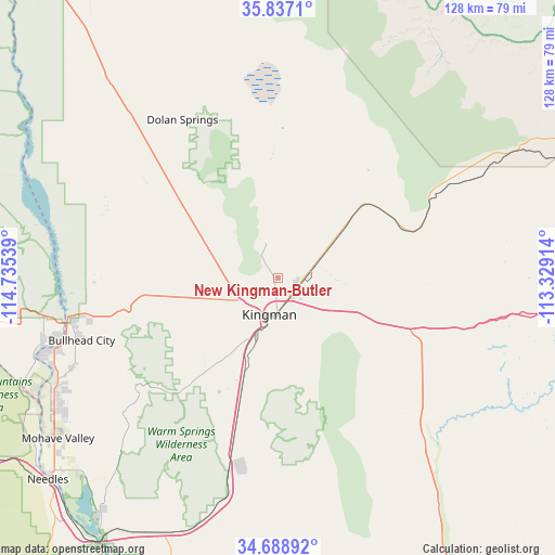
New Kingman-Butler GPS coordinates[2]
35° 15' 54.144" North, 114° 1' 56.136" West
| Map corner | latitude | longitude |
|---|---|---|
| Upper-left | 35.8371°, | -114.73539° |
| Center: | 35.26504°, | -114.03226° |
| Lower-right: | 34.68892°, | -113.32914° |
| Map W x H: | 127.7×127.7 km | = 79.3×79.3mi |
| max Lat: | 71.29058° ⇑73.8% North |
| New Kingman-Butler: | 35.26504° |
| min Lat: | ⇓26.2% South 19.06759° |
| min Long | New Kingman-But | max Long |
| -171.73463° | -114.03226° | -66.98998° |
| W 11.6%⇐ | ⇒88.4% E |
Elevation
Elevation of New Kingman-Butler is 1047 m = 3435 ft, and this is 752.2 m = 2468 ft above average elevation for this country.
| Max E: |
3189 m = 10463 ft | 6.3% |
| New Kingman-Butler | 1047 m 3435 ft | |
| Avg. | 294.8 m = 967 ft | |
Min E: |
-60 m = -197 ft | 93.7% |
See also: United States elevation on elevation.city.
Geographical zone
New Kingman-Butler is located in North temperate zone (between Tropic of Cancer and the Arctic Circle). Distance of this Northern Tropic circle is 1315.2 km =817.2 mi to South.| Distance of | km | miles | from New Kingman-Butler |
|---|---|---|---|
| North Pole | 6086 | 3781.7 | to North |
| Arctic Circle | 3480.1 | 2162.4 | to North |
| Tropic Cancer | 1315.2 | 817.2 | to South |
| Equator | 3921.1 | 2436.5 | to South |


Nearby cities:
15 places around New Kingman-Butler: (largest is in red/bold)
• Arizona Village
68 km =42.3 mi,  227°
227°
• Bullhead City
50.4 km =31.3 mi,  255°
255°
• Dolan Springs
42.4 km =26.3 mi,  329°
329°
• Golden Shores
67.3 km =41.8 mi,  217°
217°
• Golden Valley
17.9 km =11.1 mi, 255°
• Kingman
8.6 km =5.3 mi,  192°
192°
• Laughlin
50.3 km =31.3 mi, 257°
• Meadview
82 km =51 mi,  357°
357°
• Mohave Valley
62.7 km =39 mi, 233°
• Needles
70.4 km =43.7 mi, 228°
• Peach Springs
62.3 km =38.7 mi,  61°
61°
• Searchlight
83.5 km =51.9 mi,  285°
285°
• Valle Vista
22.3 km =13.9 mi,  43°
43°
• Walnut Creek
17.2 km =10.7 mi,  209°
209°
• Willow Valley
65.4 km =40.6 mi, 233°
Sources, notices
• [Note1] Compared only with cities in United States existing in our database
• [Src1] Map data: © OpenStreetMap contributors (CC-BY-SA)
• [Src2] Other city data from geonames.org with taken over terms of usage.
• [Src3] Geographical zone / Annual Mean Temperature by Robert A. Rohde @ Wikipedia
