Youngtown geodata
Youngtown (Arizona) is a populated place; located in United States in America/Phoenix (GMT-7) time zone. With population of 6,613 people, there are 6043 cities with bigger population in this country. Compared to other cities in United States, 82.7% of cities are located further ↑North; 87.9% of cities are located further →East and 78.8% of cities have lower elevation than Youngtown. Note1


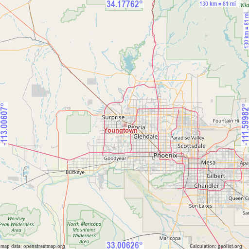
Youngtown GPS coordinates[2]
33° 35' 38.148" North, 112° 18' 10.584" West
| Map corner | latitude | longitude |
|---|---|---|
| Upper-left | 34.17762°, | -113.00607° |
| Center: | 33.59393°, | -112.30294° |
| Lower-right: | 33.00626°, | -111.59982° |
| Map W x H: | 130.2×130.2 km | = 80.9×80.9mi |
| max Lat: | 71.29058° ⇑82.7% North |
| Youngtown: | 33.59393° |
| min Lat: | ⇓17.3% South 19.06759° |
| min Long | Youngtown | max Long |
| -171.73463° | -112.30294° | -66.98998° |
| W 12.1%⇐ | ⇒87.9% E |
Elevation
Elevation of Youngtown is 343 m = 1125 ft, and this is 48.2 m = 158 ft above average elevation for this country.
| Max E: |
3189 m = 10463 ft | 21.2% |
| Youngtown | 343 m 1125 ft | |
| Avg. | 294.8 m = 967 ft | |
Min E: |
-60 m = -197 ft | 78.8% |
See also: United States elevation on elevation.city.
Geographical zone
Youngtown is located in North temperate zone (between Tropic of Cancer and the Arctic Circle). Distance of this Northern Tropic circle is 1129.4 km =701.8 mi to South.| Distance of | km | miles | from Youngtown |
|---|---|---|---|
| North Pole | 6271.8 | 3897.1 | to North |
| Arctic Circle | 3665.9 | 2277.9 | to North |
| Tropic Cancer | 1129.4 | 701.8 | to South |
| Equator | 3735.3 | 2321 | to South |


Nearby cities:
15 places around Youngtown: (largest is in red/bold)
• Alhambra
18.9 km =11.7 mi,  124°
124°
• Avondale
18.1 km =11.2 mi,  193°
193°
• Citrus Park
14 km =8.7 mi,  248°
248°
• Deer Valley
18.5 km =11.5 mi,  57°
57°
• El Mirage
2.9 km =1.8 mi,  316°
316°
• Encanto
24.4 km =15.2 mi, 121°
• Glendale
12.5 km =7.8 mi, 119°
• Goodyear
18.4 km =11.4 mi,  196°
196°
• Litchfield Park
12.3 km =7.6 mi, 204°
• Maryvale
15.5 km =9.6 mi,  131°
131°
• Peoria
6.3 km =3.9 mi,  103°
103°
• Sun City
2.9 km =1.8 mi,  82°
82°
• Sun City West
8.4 km =5.2 mi,  334°
334°
• Surprise
4.9 km =3 mi, 325°
• Tolleson
16.5 km =10.3 mi,  165°
165°
Sources, notices
• [Note1] Compared only with cities in United States existing in our database
• [Src1] Map data: © OpenStreetMap contributors (CC-BY-SA)
• [Src2] Other city data from geonames.org with taken over terms of usage.
• [Src3] Geographical zone / Annual Mean Temperature by Robert A. Rohde @ Wikipedia
