Elkhorn geodata
Elkhorn (California) is a populated place; located in United States in America/Los_Angeles (GMT-7) time zone. With population of 1,565 people, there are 13422 cities with bigger population in this country. Compared to other cities in United States, 66.8% of cities are located further ↑North; 94.6% of cities are located further →East and 99.8% of cities have higher elevation than Elkhorn. Note1


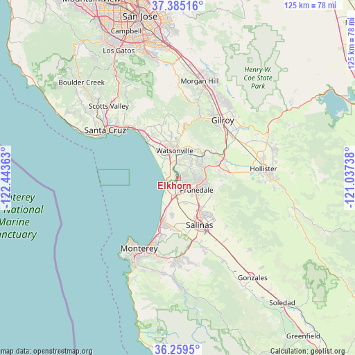
Elkhorn GPS coordinates[2]
36° 49' 27.84" North, 121° 44' 25.8" West
| Map corner | latitude | longitude |
|---|---|---|
| Upper-left | 37.38516°, | -122.44363° |
| Center: | 36.8244°, | -121.7405° |
| Lower-right: | 36.2595°, | -121.03738° |
| Map W x H: | 125.2×125.2 km | = 77.8×77.8mi |
| max Lat: | 71.29058° ⇑66.8% North |
| Elkhorn: | 36.8244° |
| min Lat: | ⇓33.2% South 19.06759° |
| min Long | Elkhorn | max Long |
| -171.73463° | -121.7405° | -66.98998° |
| W 5.4%⇐ | ⇒94.6% E |
Elevation
Elevation of Elkhorn is -1 m = -3 ft, and this is 295.8 m = 970 ft below average elevation for this country.
| Max E: |
3189 m = 10463 ft | 99.8% |
| Avg. | 294.8 m = 967 ft | |
| Elkhorn | -1 m = -3 ft | |
Min E: |
-60 m = -197 ft | 0.2% |
See also: United States elevation on elevation.city.
Geographical zone
Elkhorn is located in North temperate zone (between Tropic of Cancer and the Arctic Circle). Distance of this Northern Tropic circle is 1488.6 km =925 mi to South.| Distance of | km | miles | from Elkhorn |
|---|---|---|---|
| North Pole | 5912.6 | 3673.9 | to North |
| Arctic Circle | 3306.7 | 2054.7 | to North |
| Tropic Cancer | 1488.6 | 925 | to South |
| Equator | 4094.5 | 2544.2 | to South |


Nearby cities:
15 places around Elkhorn: (largest is in red/bold)
• Amesti
15.8 km =9.8 mi,  347°
347°
• Aptos Hills-Larkin Valley
17.3 km =10.7 mi,  331°
331°
• Aromas
11.2 km =7 mi,  50°
50°
• Boronda
15.1 km =9.4 mi,  157°
157°
• Castroville
6.7 km =4.2 mi,  193°
193°
• Freedom
12.7 km =7.9 mi, 346°
• Interlaken
14.1 km =8.8 mi,  2°
2°
• La Selva Beach
16.7 km =10.4 mi,  318°
318°
• Las Lomas
4.6 km =2.9 mi,  6°
6°
• Marina
16.5 km =10.3 mi,  199°
199°
• Pajaro
8.9 km =5.5 mi,  355°
355°
• Prunedale
8.3 km =5.2 mi,  130°
130°
• Salinas
18 km =11.2 mi, 155°
• San Juan Bautista
18.2 km =11.3 mi,  82°
82°
• Watsonville
9.7 km =6 mi, 351°
Sources, notices
• [Note1] Compared only with cities in United States existing in our database
• [Src1] Map data: © OpenStreetMap contributors (CC-BY-SA)
• [Src2] Other city data from geonames.org with taken over terms of usage.
• [Src3] Geographical zone / Annual Mean Temperature by Robert A. Rohde @ Wikipedia
