Watsonville geodata
Watsonville (California) is a populated place; located in United States in America/Los_Angeles (GMT-7) time zone. With population of 53,628 people, there are 871 cities with bigger population in this country. Compared to other cities in United States, 66.5% of cities are located further ↑North; 94.6% of cities are located further →East and 93.9% of cities have higher elevation than Watsonville. Note1


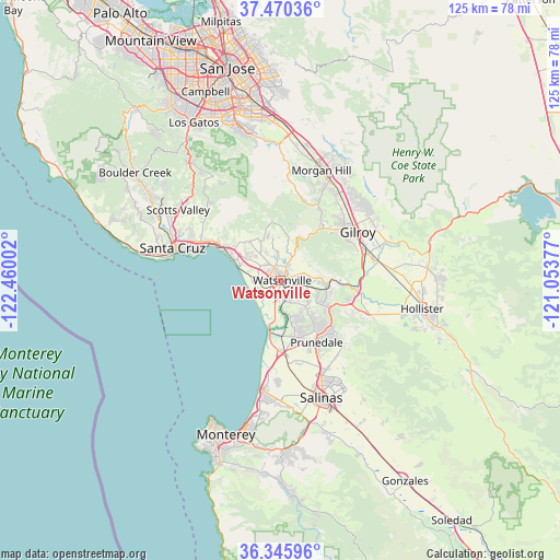
Watsonville GPS coordinates[2]
36° 54' 36.828" North, 121° 45' 24.804" West
| Map corner | latitude | longitude |
|---|---|---|
| Upper-left | 37.47036°, | -122.46002° |
| Center: | 36.91023°, | -121.75689° |
| Lower-right: | 36.34596°, | -121.05377° |
| Map W x H: | 125×125 km | = 77.7×77.7mi |
| max Lat: | 71.29058° ⇑66.5% North |
| Watsonville: | 36.91023° |
| min Lat: | ⇓33.5% South 19.06759° |
| min Long | Watsonville | max Long |
| -171.73463° | -121.75689° | -66.98998° |
| W 5.4%⇐ | ⇒94.6% E |
Elevation
Elevation of Watsonville is 10 m = 33 ft, and this is 284.8 m = 934 ft below average elevation for this country.
| Max E: |
3189 m = 10463 ft | 93.9% |
| Avg. | 294.8 m = 967 ft | |
| Watsonville | 10 m = 33 ft | |
Min E: |
-60 m = -197 ft | 6.1% |
See also: Watsonville elevation on elevation.city.
Geographical zone
Watsonville is located in North temperate zone (between Tropic of Cancer and the Arctic Circle). Distance of this Northern Tropic circle is 1498.1 km =930.9 mi to South.| Distance of | km | miles | from Watsonville |
|---|---|---|---|
| North Pole | 5903 | 3668 | to North |
| Arctic Circle | 3297.1 | 2048.7 | to North |
| Tropic Cancer | 1498.1 | 930.9 | to South |
| Equator | 4104 | 2550.1 | to South |


Nearby cities:
15 places around Watsonville: (largest is in red/bold)
• Amesti
6.3 km =3.9 mi,  341°
341°
• Aptos
14.7 km =9.1 mi,  300°
300°
• Aptos Hills-Larkin Valley
8.9 km =5.5 mi,  309°
309°
• Aromas
10.4 km =6.5 mi,  103°
103°
• Castroville
16.1 km =10 mi,  180°
180°
• Corralitos
9.8 km =6.1 mi,  333°
333°
• Elkhorn
9.7 km =6 mi,  171°
171°
• Freedom
3.1 km =1.9 mi, 332°
• Interlaken
5 km =3.1 mi,  24°
24°
• La Selva Beach
10 km =6.2 mi,  287°
287°
• Las Lomas
5.4 km =3.4 mi,  158°
158°
• Pajaro
1 km =0.6 mi,  132°
132°
• Prunedale
16.8 km =10.4 mi,  152°
152°
• Rio Del Mar
14.3 km =8.9 mi, 296°
• Seacliff
15.8 km =9.8 mi, 296°
Sources, notices
• [Note1] Compared only with cities in United States existing in our database
• [Src1] Map data: © OpenStreetMap contributors (CC-BY-SA)
• [Src2] Other city data from geonames.org with taken over terms of usage.
• [Src3] Geographical zone / Annual Mean Temperature by Robert A. Rohde @ Wikipedia
