Kettleman City geodata
Kettleman City (California) is a populated place; located in United States in America/Los_Angeles (GMT-7) time zone. With population of 1,439 people, there are 13926 cities with bigger population in this country. Compared to other cities in United States, 70.4% of cities are located further ↑North; 92.8% of cities are located further →East and 73.3% of cities have higher elevation than Kettleman City. Note1


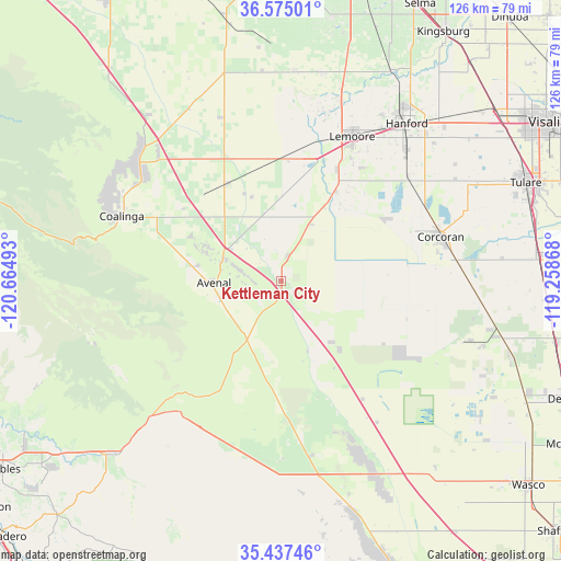
Kettleman City GPS coordinates[2]
36° 0' 29.844" North, 119° 57' 42.48" West
| Map corner | latitude | longitude |
|---|---|---|
| Upper-left | 36.57501°, | -120.66493° |
| Center: | 36.00829°, | -119.9618° |
| Lower-right: | 35.43746°, | -119.25868° |
| Map W x H: | 126.5×126.5 km | = 78.6×78.6mi |
| max Lat: | 71.29058° ⇑70.4% North |
| Kettleman City: | 36.00829° |
| min Lat: | ⇓29.6% South 19.06759° |
| min Long | Kettleman City | max Long |
| -171.73463° | -119.9618° | -66.98998° |
| W 7.2%⇐ | ⇒92.8% E |
Elevation
Elevation of Kettleman City is 81 m = 266 ft, and this is 213.8 m = 701 ft below average elevation for this country.
| Max E: |
3189 m = 10463 ft | 73.3% |
| Avg. | 294.8 m = 967 ft | |
| Kettleman City | 81 m = 266 ft | |
Min E: |
-60 m = -197 ft | 26.7% |
See also: United States elevation on elevation.city.
Geographical zone
Kettleman City is located in North temperate zone (between Tropic of Cancer and the Arctic Circle). Distance of this Northern Tropic circle is 1397.8 km =868.6 mi to South.| Distance of | km | miles | from Kettleman City |
|---|---|---|---|
| North Pole | 6003.3 | 3730.3 | to North |
| Arctic Circle | 3397.4 | 2111 | to North |
| Tropic Cancer | 1397.8 | 868.6 | to South |
| Equator | 4003.7 | 2487.8 | to South |


Nearby cities:
15 places around Kettleman City: (largest is in red/bold)
• Alpaugh
44.8 km =27.8 mi,  107°
107°
• Armona
41.1 km =25.5 mi,  33°
33°
• Avenal
15 km =9.3 mi,  268°
268°
• Coalinga
38.7 km =24 mi,  292°
292°
• Corcoran
37.4 km =23.2 mi,  74°
74°
• Hanford
45.4 km =28.2 mi,  38°
38°
• Home Garden
43.9 km =27.3 mi, 41°
• Huron
25.1 km =15.6 mi,  329°
329°
• Lanare
47 km =29.2 mi,  3°
3°
• Lemoore
36.3 km =22.6 mi, 26°
• Lemoore Station
28.8 km =17.9 mi,  10°
10°
• Lost Hills
49.8 km =30.9 mi,  151°
151°
• Lucerne
49.3 km =30.6 mi, 32°
• Riverdale
47.9 km =29.8 mi, 11°
• Stratford
23.7 km =14.7 mi, 31°
Sources, notices
• [Note1] Compared only with cities in United States existing in our database
• [Src1] Map data: © OpenStreetMap contributors (CC-BY-SA)
• [Src2] Other city data from geonames.org with taken over terms of usage.
• [Src3] Geographical zone / Annual Mean Temperature by Robert A. Rohde @ Wikipedia
