Newcastle geodata
Newcastle (California) is a populated place; located in United States in America/Los_Angeles (GMT-7) time zone. With population of 1,224 people, there are 14984 cities with bigger population in this country. Compared to other cities in United States, 56% of cities are located further ↑North; 93.9% of cities are located further →East and 70.9% of cities have lower elevation than Newcastle. Note1


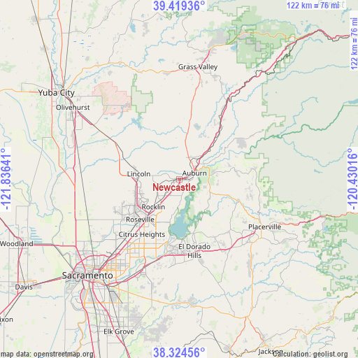
Newcastle GPS coordinates[2]
38° 52' 26.652" North, 121° 7' 59.808" West
| Map corner | latitude | longitude |
|---|---|---|
| Upper-left | 39.41936°, | -121.83641° |
| Center: | 38.87407°, | -121.13328° |
| Lower-right: | 38.32456°, | -120.43016° |
| Map W x H: | 121.7×121.7 km | = 75.6×75.6mi |
| max Lat: | 71.29058° ⇑56% North |
| Newcastle: | 38.87407° |
| min Lat: | ⇓44% South 19.06759° |
| min Long | Newcastle | max Long |
| -171.73463° | -121.13328° | -66.98998° |
| W 6.1%⇐ | ⇒93.9% E |
Elevation
Elevation of Newcastle is 290 m = 951 ft, and this is 4.8 m = 16 ft below average elevation for this country.
| Max E: |
3189 m = 10463 ft | 29.1% |
| Avg. | 294.8 m = 967 ft | |
| Newcastle | 290 m = 951 ft | |
Min E: |
-60 m = -197 ft | 70.9% |
See also: United States elevation on elevation.city.
Geographical zone
Newcastle is located in North temperate zone (between Tropic of Cancer and the Arctic Circle). Distance of this Northern Tropic circle is 1716.5 km =1066.6 mi to South.| Distance of | km | miles | from Newcastle |
|---|---|---|---|
| North Pole | 5684.7 | 3532.3 | to North |
| Arctic Circle | 3078.8 | 1913.1 | to North |
| Tropic Cancer | 1716.5 | 1066.6 | to South |
| Equator | 4322.4 | 2685.8 | to South |


Nearby cities:
15 places around Newcastle: (largest is in red/bold)
• Auburn
5.5 km =3.4 mi,  62°
62°
• Auburn Lake Trails
16.3 km =10.1 mi,  74°
74°
• Coloma
22.6 km =14 mi,  111°
111°
• Cool
10.4 km =6.5 mi,  81°
81°
• El Dorado Hills
21.4 km =13.3 mi,  168°
168°
• Folsom
22.1 km =13.7 mi,  189°
189°
• Granite Bay
12.6 km =7.8 mi, 192°
• Lake of the Pines
19.6 km =12.2 mi,  19°
19°
• Lincoln
14 km =8.7 mi,  278°
278°
• Loomis
7.8 km =4.8 mi,  221°
221°
• Meadow Vista
17.1 km =10.6 mi,  34°
34°
• North Auburn
7.8 km =4.8 mi, 34°
• Penryn
4 km =2.5 mi,  232°
232°
• Rocklin
12.8 km =8 mi, 223°
• Roseville
19.1 km =11.9 mi, 224°
Sources, notices
• [Note1] Compared only with cities in United States existing in our database
• [Src1] Map data: © OpenStreetMap contributors (CC-BY-SA)
• [Src2] Other city data from geonames.org with taken over terms of usage.
• [Src3] Geographical zone / Annual Mean Temperature by Robert A. Rohde @ Wikipedia
