Poway geodata
Poway (California) is a populated place; located in United States in America/Los_Angeles (GMT-7) time zone. With population of 50,157 people, there are 947 cities with bigger population in this country. Compared to other cities in United States, 85.3% of cities are located further ↑North; 89.8% of cities are located further →East and 59.5% of cities have higher elevation than Poway. Note1


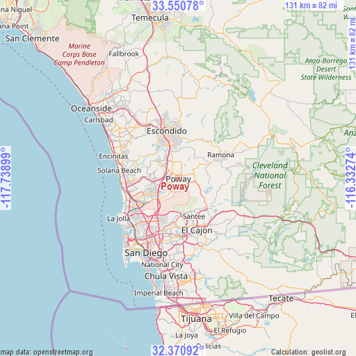
Poway GPS coordinates[2]
32° 57' 46.152" North, 117° 2' 9.096" West
| Map corner | latitude | longitude |
|---|---|---|
| Upper-left | 33.55078°, | -117.73899° |
| Center: | 32.96282°, | -117.03586° |
| Lower-right: | 32.37092°, | -116.33274° |
| Map W x H: | 131.2×131.2 km | = 81.5×81.5mi |
| max Lat: | 71.29058° ⇑85.3% North |
| Poway: | 32.96282° |
| min Lat: | ⇓14.7% South 19.06759° |
| min Long | Poway | max Long |
| -171.73463° | -117.03586° | -66.98998° |
| W 10.2%⇐ | ⇒89.8% E |
Elevation
Elevation of Poway is 157 m = 515 ft, and this is 137.8 m = 452 ft below average elevation for this country.
| Max E: |
3189 m = 10463 ft | 59.5% |
| Avg. | 294.8 m = 967 ft | |
| Poway | 157 m = 515 ft | |
Min E: |
-60 m = -197 ft | 40.5% |
See also: Poway elevation on elevation.city.
Geographical zone
Poway is located in North temperate zone (between Tropic of Cancer and the Arctic Circle). Distance of this Northern Tropic circle is 1059.2 km =658.2 mi to South.| Distance of | km | miles | from Poway |
|---|---|---|---|
| North Pole | 6341.9 | 3940.7 | to North |
| Arctic Circle | 3736.1 | 2321.5 | to North |
| Tropic Cancer | 1059.2 | 658.2 | to South |
| Equator | 3665.1 | 2277.4 | to South |


Nearby cities:
15 places around Poway: (largest is in red/bold)
• Bostonia
19.6 km =12.2 mi,  151°
151°
• El Cajon
19.9 km =12.4 mi,  159°
159°
• Escondido
18 km =11.2 mi,  344°
344°
• Eucalyptus Hills
12.4 km =7.7 mi,  137°
137°
• Fairbanks Ranch
14.5 km =9 mi,  283°
283°
• Hidden Trails
19.7 km =12.2 mi,  3°
3°
• Lakeside
15.8 km =9.8 mi, 137°
• Mira Mesa
11.4 km =7.1 mi,  242°
242°
• Ramona
17.9 km =11.1 mi,  60°
60°
• Rancho Penasquitos
7.4 km =4.6 mi,  267°
267°
• Rancho Santa Fe
16.8 km =10.4 mi,  292°
292°
• San Pasqual
16.2 km =10.1 mi,  28°
28°
• Santee
15 km =9.3 mi, 157°
• Sorrento Valley
16.4 km =10.2 mi, 244°
• Winter Gardens
17.5 km =10.9 mi, 146°
Sources, notices
• [Note1] Compared only with cities in United States existing in our database
• [Src1] Map data: © OpenStreetMap contributors (CC-BY-SA)
• [Src2] Other city data from geonames.org with taken over terms of usage.
• [Src3] Geographical zone / Annual Mean Temperature by Robert A. Rohde @ Wikipedia
