Salton City geodata
Salton City (California) is a populated place; located in United States in America/Los_Angeles (GMT-7) time zone. With population of 3,763 people, there are 8507 cities with bigger population in this country. Compared to other cities in United States, 84% of cities are located further ↑North; 89.1% of cities are located further →East and 100% of cities have higher elevation than Salton City. Note1


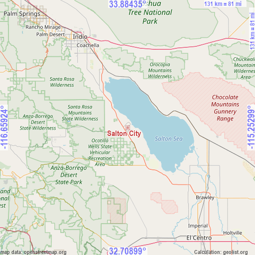
Salton City GPS coordinates[2]
33° 17' 55.14" North, 115° 57' 21.996" West
| Map corner | latitude | longitude |
|---|---|---|
| Upper-left | 33.88435°, | -116.65924° |
| Center: | 33.29865°, | -115.95611° |
| Lower-right: | 32.70899°, | -115.25299° |
| Map W x H: | 130.7×130.7 km | = 81.2×81.2mi |
| max Lat: | 71.29058° ⇑84% North |
| Salton City: | 33.29865° |
| min Lat: | ⇓16% South 19.06759° |
| min Long | Salton City | max Long |
| -171.73463° | -115.95611° | -66.98998° |
| W 10.9%⇐ | ⇒89.1% E |
Elevation
Elevation of Salton City is -38 m = -125 ft, and this is 332.8 m = 1092 ft below average elevation for this country.
| Max E: |
3189 m = 10463 ft | 100% |
| Avg. | 294.8 m = 967 ft | |
| Salton City | -38 m = -125 ft | |
Min E: |
-60 m = -197 ft | 0% |
See also: United States elevation on elevation.city.
Geographical zone
Salton City is located in North temperate zone (between Tropic of Cancer and the Arctic Circle). Distance of this Northern Tropic circle is 1096.5 km =681.3 mi to South.| Distance of | km | miles | from Salton City |
|---|---|---|---|
| North Pole | 6304.6 | 3917.5 | to North |
| Arctic Circle | 3698.7 | 2298.3 | to North |
| Tropic Cancer | 1096.5 | 681.3 | to South |
| Equator | 3702.5 | 2300.6 | to South |


Nearby cities:
15 places around Salton City: (largest is in red/bold)
• Bermuda Dunes
58.2 km =36.2 mi,  327°
327°
• Borrego Springs
39.2 km =24.4 mi,  263°
263°
• Brawley
53.3 km =33.1 mi,  131°
131°
• Calipatria
45.4 km =28.2 mi,  115°
115°
• Coachella
47 km =29.2 mi, 334°
• Desert Shores
14.1 km =8.8 mi, 326°
• Indian Wells
58.8 km =36.5 mi,  322°
322°
• Indio
52.8 km =32.8 mi, 332°
• La Quinta
52.2 km =32.4 mi, 321°
• Mecca
32.5 km =20.2 mi,  339°
339°
• Niland
41.2 km =25.6 mi,  99°
99°
• Oasis
22.8 km =14.2 mi, 324°
• Thermal
41.6 km =25.8 mi, 335°
• Vista Santa Rosa
43.9 km =27.3 mi, 326°
• Westmorland
42.6 km =26.5 mi, 133°
Sources, notices
• [Note1] Compared only with cities in United States existing in our database
• [Src1] Map data: © OpenStreetMap contributors (CC-BY-SA)
• [Src2] Other city data from geonames.org with taken over terms of usage.
• [Src3] Geographical zone / Annual Mean Temperature by Robert A. Rohde @ Wikipedia
