West Rancho Dominguez geodata
West Rancho Dominguez (California) is a populated place; located in United States in America/Los_Angeles (GMT-7) time zone. With population of 5,669 people, there are 6632 cities with bigger population in this country. Compared to other cities in United States, 81% of cities are located further ↑North; 91.3% of cities are located further →East and 85.4% of cities have higher elevation than West Rancho Dominguez. Note1
Current local time in West Rancho Dominguez:
11:55 AM, WednesdayDifference from your time zone: hours


West Rancho Dominguez GPS coordinates[2]
33° 53' 38.04" North, 118° 16' 14.268" West
| Map corner | latitude | longitude |
|---|---|---|
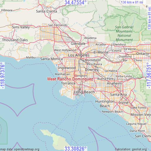
| Upper-left | 34.47554°, | -118.97376° |
| Center: | 33.8939°, | -118.27063° |
| Lower-right: | 33.30826°, | -117.56751° |
| Map W x H: | 129.8×129.8 km | = 80.7×80.7mi |
| max Lat: | 71.29058° ⇑81% North |
| West Rancho Dominguez: | 33.8939° |
| min Lat: | ⇓19% South 19.06759° |
| min Long | West Rancho Dom | max Long |
| -171.73463° | -118.27063° | -66.98998° |
| W 8.7%⇐ | ⇒91.3% E |
Elevation
Elevation of West Rancho Dominguez is 27 m = 89 ft, and this is 267.8 m = 879 ft below average elevation for this country.
| Max E: |
3189 m = 10463 ft | 85.4% |
| Avg. | 294.8 m = 967 ft | |
| West Rancho Dominguez | 27 m = 89 ft | |
Min E: |
-60 m = -197 ft | 14.6% |
See also: United States elevation on elevation.city.
Geographical zone
West Rancho Dominguez is located in North temperate zone (between Tropic of Cancer and the Arctic Circle). Distance of this Northern Tropic circle is 1162.7 km =722.5 mi to South.| Distance of | km | miles | from West Rancho Dominguez |
|---|---|---|---|
| North Pole | 6238.4 | 3876.4 | to North |
| Arctic Circle | 3632.5 | 2257.1 | to North |
| Tropic Cancer | 1162.7 | 722.5 | to South |
| Equator | 3768.6 | 2341.7 | to South |


Nearby cities:
15 places around West Rancho Dominguez: (largest is in red/bold)
• Alondra Park
5.6 km =3.5 mi,  264°
264°
• Carson
7 km =4.3 mi,  188°
188°
• Compton
4.7 km =2.9 mi,  87°
87°
• East Rancho Dominguez
7 km =4.3 mi, 86°
• Florence-Graham
8.6 km =5.3 mi,  16°
16°
• Gardena
3.6 km =2.2 mi, 260°
• Hawthorne
8 km =5 mi,  288°
288°
• Lawndale
7.6 km =4.7 mi, 264°
• Lennox
9 km =5.6 mi,  303°
303°
• Lynwood
6.8 km =4.2 mi,  53°
53°
• South Gate
8.7 km =5.4 mi,  38°
38°
• West Athens
4.5 km =2.8 mi,  317°
317°
• West Carson
8.3 km =5.2 mi, 194°
• Westmont
6 km =3.7 mi,  331°
331°
• Willowbrook
2.9 km =1.8 mi,  29°
29°
Sources, notices
• [Note1] Compared only with cities in United States existing in our database
• [Src1] Map data: © OpenStreetMap contributors (CC-BY-SA)
• [Src2] Other city data from geonames.org with taken over terms of usage.
• [Src3] Geographical zone / Annual Mean Temperature by Robert A. Rohde @ Wikipedia
