Columbine Valley geodata
Columbine Valley (Colorado) is a populated place; located in United States in America/Denver (GMT-6) time zone. With population of 1,360 people, there are 14307 cities with bigger population in this country. Compared to other cities in United States, 50.1% of cities are located further ↑North; 83.3% of cities are located further →East and 97.6% of cities have lower elevation than Columbine Valley. Note1


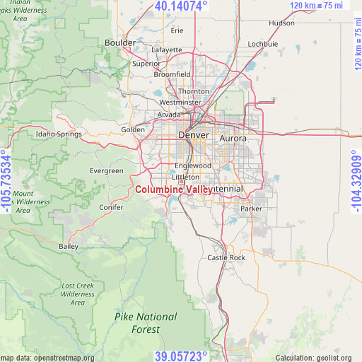
Columbine Valley GPS coordinates[2]
39° 36' 3.96" North, 105° 1' 55.956" West
| Map corner | latitude | longitude |
|---|---|---|
| Upper-left | 40.14074°, | -105.73534° |
| Center: | 39.6011°, | -105.03221° |
| Lower-right: | 39.05723°, | -104.32909° |
| Map W x H: | 120.5×120.5 km | = 74.9×74.9mi |
| max Lat: | 71.29058° ⇑50.1% North |
| Columbine Valley: | 39.6011° |
| min Lat: | ⇓49.9% South 19.06759° |
| min Long | Columbine Valle | max Long |
| -171.73463° | -105.03221° | -66.98998° |
| W 16.7%⇐ | ⇒83.3% E |
Elevation
Elevation of Columbine Valley is 1635 m = 5364 ft, and this is 1340.2 m = 4397 ft above average elevation for this country.
| Max E: |
3189 m = 10463 ft | 2.4% |
| Columbine Valley | 1635 m 5364 ft | |
| Avg. | 294.8 m = 967 ft | |
Min E: |
-60 m = -197 ft | 97.6% |
See also: United States elevation on elevation.city.
Geographical zone
Columbine Valley is located in North temperate zone (between Tropic of Cancer and the Arctic Circle). Distance of this Northern Tropic circle is 1797.3 km =1116.8 mi to South.| Distance of | km | miles | from Columbine Valley |
|---|---|---|---|
| North Pole | 5603.8 | 3482 | to North |
| Arctic Circle | 2997.9 | 1862.8 | to North |
| Tropic Cancer | 1797.3 | 1116.8 | to South |
| Equator | 4403.2 | 2736 | to South |


Nearby cities:
15 places around Columbine Valley: (largest is in red/bold)
• Acres Green
12.7 km =7.9 mi,  112°
112°
• Bow Mar
3.4 km =2.1 mi,  333°
333°
• Castlewood
11.4 km =7.1 mi,  99°
99°
• Cherry Creek
13.3 km =8.3 mi,  73°
73°
• Cherry Hills Village
7.7 km =4.8 mi,  54°
54°
• Columbine
3.5 km =2.2 mi,  245°
245°
• Englewood
6.4 km =4 mi,  36°
36°
• Greenwood Village
7.2 km =4.5 mi,  75°
75°
• Highlands Ranch
7.5 km =4.7 mi,  134°
134°
• Holly Hills
12.3 km =7.6 mi, 52°
• Ken Caryl
7.4 km =4.6 mi, 247°
• Lakewood
12.3 km =7.6 mi,  339°
339°
• Littleton
1.9 km =1.2 mi, 44°
• Sheridan
5.1 km =3.2 mi,  6°
6°
• Southglenn
7 km =4.3 mi, 102°
Sources, notices
• [Note1] Compared only with cities in United States existing in our database
• [Src1] Map data: © OpenStreetMap contributors (CC-BY-SA)
• [Src2] Other city data from geonames.org with taken over terms of usage.
• [Src3] Geographical zone / Annual Mean Temperature by Robert A. Rohde @ Wikipedia
