Carrizozo geodata
Carrizozo (New Mexico) is a seat of a second-order administrative division; located in United States in America/Denver (GMT-6) time zone. With population of 941 people, there are 16706 cities with bigger population in this country. Compared to other cities in United States, 82.4% of cities are located further ↑North; 83.8% of cities are located further →East and 97.7% of cities have lower elevation than Carrizozo. Note1


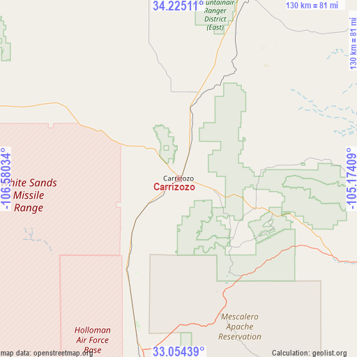
Carrizozo GPS coordinates[2]
33° 38' 30.264" North, 105° 52' 37.956" West
| Map corner | latitude | longitude |
|---|---|---|
| Upper-left | 34.22511°, | -106.58034° |
| Center: | 33.64174°, | -105.87721° |
| Lower-right: | 33.05439°, | -105.17409° |
| Map W x H: | 130.2×130.2 km | = 80.9×80.9mi |
| max Lat: | 71.29058° ⇑82.4% North |
| Carrizozo: | 33.64174° |
| min Lat: | ⇓17.6% South 19.06759° |
| min Long | Carrizozo | max Long |
| -171.73463° | -105.87721° | -66.98998° |
| W 16.2%⇐ | ⇒83.8% E |
Elevation
Elevation of Carrizozo is 1657 m = 5436 ft, and this is 1362.2 m = 4469 ft above average elevation for this country.
| Max E: |
3189 m = 10463 ft | 2.3% |
| Carrizozo | 1657 m 5436 ft | |
| Avg. | 294.8 m = 967 ft | |
Min E: |
-60 m = -197 ft | 97.7% |
See also: United States elevation on elevation.city.
Geographical zone
Carrizozo is located in North temperate zone (between Tropic of Cancer and the Arctic Circle). Distance of this Northern Tropic circle is 1134.7 km =705.1 mi to South.| Distance of | km | miles | from Carrizozo |
|---|---|---|---|
| North Pole | 6266.5 | 3893.8 | to North |
| Arctic Circle | 3660.6 | 2274.6 | to North |
| Tropic Cancer | 1134.7 | 705.1 | to South |
| Equator | 3740.6 | 2324.3 | to South |


Nearby cities:
15 places around Carrizozo: (largest is in red/bold)
• Alamogordo
82.9 km =51.5 mi,  185°
185°
• Boles Acres
93.4 km =58 mi, 186°
• Capitan
30.2 km =18.8 mi,  110°
110°
• Cloudcroft
77.1 km =47.9 mi,  170°
170°
• Estancia
125.2 km =77.8 mi,  352°
352°
• High Rolls
76.9 km =47.8 mi,  177°
177°
• Holloman Air Force Base
90.6 km =56.3 mi, 193°
• La Luz
74.1 km =46 mi, 184°
• Mescalero
54.7 km =34 mi, 169°
• Mountainair
103.3 km =64.2 mi,  341°
341°
• Roswell
128.3 km =79.7 mi,  102°
102°
• Ruidoso
39.3 km =24.4 mi,  151°
151°
• Ruidoso Downs
43 km =26.7 mi,  143°
143°
• Socorro
104.5 km =64.9 mi,  296°
296°
• Tularosa
64.5 km =40.1 mi, 191°
Sources, notices
• [Note1] Compared only with cities in United States existing in our database
• [Src1] Map data: © OpenStreetMap contributors (CC-BY-SA)
• [Src2] Other city data from geonames.org with taken over terms of usage.
• [Src3] Geographical zone / Annual Mean Temperature by Robert A. Rohde @ Wikipedia
