Ruidoso Downs geodata
Ruidoso Downs (New Mexico) is a populated place; located in United States in America/Denver (GMT-6) time zone. With population of 2,586 people, there are 10426 cities with bigger population in this country. Compared to other cities in United States, 83.9% of cities are located further ↑North; 83.7% of cities are located further →East and 99% of cities have lower elevation than Ruidoso Downs. Note1


Ruidoso Downs GPS coordinates[2]
33° 19' 44.292" North, 105° 36' 15.948" West
| Map corner | latitude | longitude |
|---|---|---|
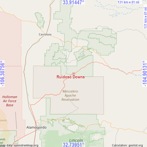
| Upper-left | 33.91447°, | -106.30756° |
| Center: | 33.32897°, | -105.60443° |
| Lower-right: | 32.73951°, | -104.90131° |
| Map W x H: | 130.6×130.6 km | = 81.2×81.2mi |
| max Lat: | 71.29058° ⇑83.9% North |
| Ruidoso Downs: | 33.32897° |
| min Lat: | ⇓16.1% South 19.06759° |
| min Long | Ruidoso Downs | max Long |
| -171.73463° | -105.60443° | -66.98998° |
| W 16.3%⇐ | ⇒83.7% E |
Elevation
Elevation of Ruidoso Downs is 1961 m = 6434 ft, and this is 1666.2 m = 5467 ft above average elevation for this country.
| Max E: |
3189 m = 10463 ft | 1% |
| Ruidoso Downs | 1961 m 6434 ft | |
| Avg. | 294.8 m = 967 ft | |
Min E: |
-60 m = -197 ft | 99% |
See also: United States elevation on elevation.city.
Geographical zone
Ruidoso Downs is located in North temperate zone (between Tropic of Cancer and the Arctic Circle). Distance of this Northern Tropic circle is 1099.9 km =683.4 mi to South.| Distance of | km | miles | from Ruidoso Downs |
|---|---|---|---|
| North Pole | 6301.2 | 3915.4 | to North |
| Arctic Circle | 3695.3 | 2296.2 | to North |
| Tropic Cancer | 1099.9 | 683.4 | to South |
| Equator | 3705.8 | 2302.7 | to South |


Nearby cities:
15 places around Ruidoso Downs: (largest is in red/bold)
• Alamogordo
58.1 km =36.1 mi,  214°
214°
• Boles Acres
68.1 km =42.3 mi, 211°
• Capitan
24.2 km =15 mi,  7°
7°
• Carrizozo
43 km =26.7 mi,  323°
323°
• Cloudcroft
43.3 km =26.9 mi,  197°
197°
• Dexter
115.4 km =71.7 mi,  97°
97°
• Hagerman
121.2 km =75.3 mi, 101°
• High Rolls
47.2 km =29.3 mi, 207°
• Holloman Air Force Base
70.6 km =43.9 mi,  220°
220°
• La Luz
50.1 km =31.1 mi, 218°
• Mescalero
24.7 km =15.3 mi, 219°
• Midway
107.3 km =66.7 mi,  92°
92°
• Roswell
100.5 km =62.4 mi, 85°
• Ruidoso
6.4 km =4 mi,  272°
272°
• Tularosa
47.8 km =29.7 mi,  233°
233°
Sources, notices
• [Note1] Compared only with cities in United States existing in our database
• [Src1] Map data: © OpenStreetMap contributors (CC-BY-SA)
• [Src2] Other city data from geonames.org with taken over terms of usage.
• [Src3] Geographical zone / Annual Mean Temperature by Robert A. Rohde @ Wikipedia
