Ajo geodata
Ajo (Arizona) is a populated place; located in United States in America/Phoenix (GMT-7) time zone. With population of 3,304 people, there are 9143 cities with bigger population in this country. Compared to other cities in United States, 87.6% of cities are located further ↑North; 88.2% of cities are located further →East and 88.6% of cities have lower elevation than Ajo. Note1


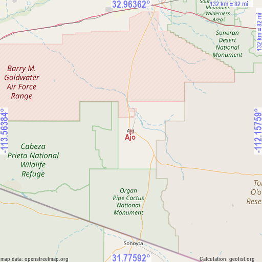
Ajo GPS coordinates[2]
32° 22' 18.192" North, 112° 51' 38.556" West
| Map corner | latitude | longitude |
|---|---|---|
| Upper-left | 32.96362°, | -113.56384° |
| Center: | 32.37172°, | -112.86071° |
| Lower-right: | 31.77592°, | -112.15759° |
| Map W x H: | 132.1×132.1 km | = 82.1×82.1mi |
| max Lat: | 71.29058° ⇑87.6% North |
| Ajo: | 32.37172° |
| min Lat: | ⇓12.4% South 19.06759° |
| min Long | Ajo | max Long |
| -171.73463° | -112.86071° | -66.98998° |
| W 11.8%⇐ | ⇒88.2% E |
Elevation
Elevation of Ajo is 535 m = 1755 ft, and this is 240.2 m = 788 ft above average elevation for this country.
| Max E: |
3189 m = 10463 ft | 11.4% |
| Ajo | 535 m 1755 ft | |
| Avg. | 294.8 m = 967 ft | |
Min E: |
-60 m = -197 ft | 88.6% |
See also: United States elevation on elevation.city.
Geographical zone
Ajo is located in North temperate zone (between Tropic of Cancer and the Arctic Circle). Distance of this Northern Tropic circle is 993.5 km =617.3 mi to South.| Distance of | km | miles | from Ajo |
|---|---|---|---|
| North Pole | 6407.7 | 3981.6 | to North |
| Arctic Circle | 3801.8 | 2362.3 | to North |
| Tropic Cancer | 993.5 | 617.3 | to South |
| Equator | 3599.4 | 2236.6 | to South |


Nearby cities:
15 places around Ajo: (largest is in red/bold)
• Ak-Chin Village
102.8 km =63.9 mi,  44°
44°
• Arizona City
119.4 km =74.2 mi,  69°
69°
• Buckeye
114 km =70.8 mi,  13°
13°
• Casa Blanca
123.3 km =76.6 mi,  47°
47°
• Casa Grande
117.7 km =73.1 mi,  61°
61°
• Gila Bend
65.5 km =40.7 mi, 11°
• Gila Crossing
119.7 km =74.4 mi,  32°
32°
• Goodyear
127.2 km =79 mi,  21°
21°
• Komatke
120.8 km =75.1 mi, 31°
• Maricopa
107.8 km =67 mi, 44°
• Santa Rosa
77.2 km =48 mi,  93°
93°
• Sells
105.4 km =65.5 mi,  118°
118°
• Stanfield
101.5 km =63.1 mi, 55°
• Tacna
108.7 km =67.5 mi,  289°
289°
• Wellton
125.1 km =77.7 mi, 285°
Sources, notices
• [Note1] Compared only with cities in United States existing in our database
• [Src1] Map data: © OpenStreetMap contributors (CC-BY-SA)
• [Src2] Other city data from geonames.org with taken over terms of usage.
• [Src3] Geographical zone / Annual Mean Temperature by Robert A. Rohde @ Wikipedia
