Casa Blanca geodata
Casa Blanca (Arizona) is a populated place; located in United States in America/Phoenix (GMT-7) time zone. With population of 1,388 people, there are 14167 cities with bigger population in this country. Compared to other cities in United States, 84.7% of cities are located further ↑North; 87.2% of cities are located further →East and 80.7% of cities have lower elevation than Casa Blanca. Note1


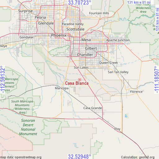
Casa Blanca GPS coordinates[2]
33° 7' 13.188" North, 111° 53' 17.484" West
| Map corner | latitude | longitude |
|---|---|---|
| Upper-left | 33.70723°, | -112.59132° |
| Center: | 33.12033°, | -111.88819° |
| Lower-right: | 32.52948°, | -111.18507° |
| Map W x H: | 131×131 km | = 81.4×81.4mi |
| max Lat: | 71.29058° ⇑84.7% North |
| Casa Blanca: | 33.12033° |
| min Lat: | ⇓15.3% South 19.06759° |
| min Long | Casa Blanca | max Long |
| -171.73463° | -111.88819° | -66.98998° |
| W 12.8%⇐ | ⇒87.2% E |
Elevation
Elevation of Casa Blanca is 361 m = 1184 ft, and this is 66.2 m = 217 ft above average elevation for this country.
| Max E: |
3189 m = 10463 ft | 19.3% |
| Casa Blanca | 361 m 1184 ft | |
| Avg. | 294.8 m = 967 ft | |
Min E: |
-60 m = -197 ft | 80.7% |
See also: United States elevation on elevation.city.
Geographical zone
Casa Blanca is located in North temperate zone (between Tropic of Cancer and the Arctic Circle). Distance of this Northern Tropic circle is 1076.7 km =669 mi to South.| Distance of | km | miles | from Casa Blanca |
|---|---|---|---|
| North Pole | 6324.4 | 3929.8 | to North |
| Arctic Circle | 3718.5 | 2310.6 | to North |
| Tropic Cancer | 1076.7 | 669 | to South |
| Equator | 3682.6 | 2288.3 | to South |


Nearby cities:
15 places around Casa Blanca: (largest is in red/bold)
• Ahwatukee Foothills
26.2 km =16.3 mi,  340°
340°
• Ak-Chin Village
21.2 km =13.2 mi,  241°
241°
• Blackwater
30.1 km =18.7 mi,  109°
109°
• Casa Grande
29.4 km =18.3 mi,  155°
155°
• Chandler
21.1 km =13.1 mi,  11°
11°
• Gila Crossing
31.2 km =19.4 mi,  303°
303°
• Gilbert
27.4 km =17 mi,  19°
19°
• Guadalupe
28.7 km =17.8 mi,  345°
345°
• Maricopa
16.4 km =10.2 mi,  245°
245°
• Queen Creek
27.6 km =17.1 mi,  58°
58°
• Sacaton
14.7 km =9.1 mi, 109°
• San Carlos
25.3 km =15.7 mi, 7°
• Santan
10.3 km =6.4 mi,  53°
53°
• Stanfield
27.3 km =17 mi,  194°
194°
• Sun Lakes
10.2 km =6.3 mi, 6°
Sources, notices
• [Note1] Compared only with cities in United States existing in our database
• [Src1] Map data: © OpenStreetMap contributors (CC-BY-SA)
• [Src2] Other city data from geonames.org with taken over terms of usage.
• [Src3] Geographical zone / Annual Mean Temperature by Robert A. Rohde @ Wikipedia
