Emmett geodata
Emmett (Idaho) is a seat of a second-order administrative division; located in United States in America/Boise (GMT-6) time zone. With population of 6,604 people, there are 6051 cities with bigger population in this country. Compared to other cities in United States, 87.9% of cities are located further ↓South; 89.4% of cities are located further →East and 91.2% of cities have lower elevation than Emmett. Note1


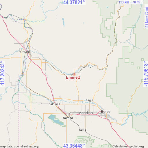
Emmett GPS coordinates[2]
43° 52' 24.6" North, 116° 29' 57.48" West
| Map corner | latitude | longitude |
|---|---|---|
| Upper-left | 44.37821°, | -117.20243° |
| Center: | 43.8735°, | -116.4993° |
| Lower-right: | 43.36448°, | -115.79618° |
| Map W x H: | 112.7×112.7 km | = 70×70mi |
| max Lat: | 71.29058° ⇑12.1% North |
| Emmett: | 43.8735° |
| min Lat: | ⇓87.9% South 19.06759° |
| min Long | Emmett | max Long |
| -171.73463° | -116.4993° | -66.98998° |
| W 10.6%⇐ | ⇒89.4% E |
Elevation
Elevation of Emmett is 725 m = 2379 ft, and this is 430.2 m = 1411 ft above average elevation for this country.
| Max E: |
3189 m = 10463 ft | 8.8% |
| Emmett | 725 m 2379 ft | |
| Avg. | 294.8 m = 967 ft | |
Min E: |
-60 m = -197 ft | 91.2% |
See also: United States elevation on elevation.city.
Geographical zone
Emmett is located in North temperate zone (between Tropic of Cancer and the Arctic Circle). Distance of this Northern Tropic circle is 2272.4 km =1412 mi to South.| Distance of | km | miles | from Emmett |
|---|---|---|---|
| North Pole | 5128.8 | 3186.9 | to North |
| Arctic Circle | 2522.9 | 1567.7 | to North |
| Tropic Cancer | 2272.4 | 1412 | to South |
| Equator | 4878.3 | 3031.2 | to South |


Nearby cities:
15 places around Emmett: (largest is in red/bold)
• Boise
37.4 km =23.2 mi,  140°
140°
• Caldwell
27.9 km =17.3 mi,  212°
212°
• Eagle
23 km =14.3 mi,  149°
149°
• Fruitland
36.6 km =22.7 mi,  294°
294°
• Garden City
34.9 km =21.7 mi, 143°
• Greenleaf
34 km =21.1 mi,  228°
228°
• Hidden Spring
26.1 km =16.2 mi,  130°
130°
• Horseshoe Bend
24.6 km =15.3 mi,  79°
79°
• Meridian
30.3 km =18.8 mi,  163°
163°
• Middleton
20.9 km =13 mi, 207°
• Nampa
37.4 km =23.2 mi,  187°
187°
• New Plymouth
27.8 km =17.3 mi, 292°
• Notus
29.3 km =18.2 mi,  235°
235°
• Parma
36.9 km =22.9 mi,  254°
254°
• Star
20.2 km =12.6 mi,  178°
178°
Sources, notices
• [Note1] Compared only with cities in United States existing in our database
• [Src1] Map data: © OpenStreetMap contributors (CC-BY-SA)
• [Src2] Other city data from geonames.org with taken over terms of usage.
• [Src3] Geographical zone / Annual Mean Temperature by Robert A. Rohde @ Wikipedia
