East Missoula geodata
East Missoula (Montana) is a populated place; located in United States in America/Denver (GMT-6) time zone. With population of 2,157 people, there are 11451 cities with bigger population in this country. Compared to other cities in United States, 96.4% of cities are located further ↓South; 88.4% of cities are located further →East and 93.4% of cities have lower elevation than East Missoula. Note1


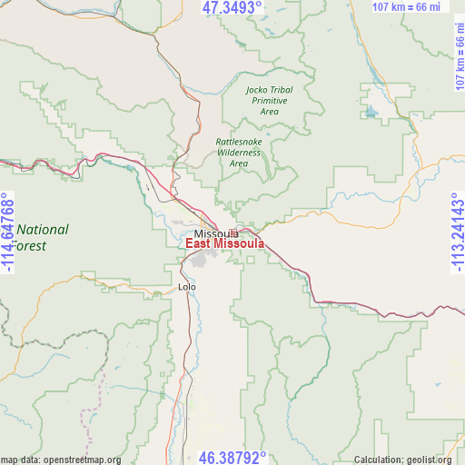
East Missoula GPS coordinates[2]
46° 52' 14.736" North, 113° 56' 40.38" West
| Map corner | latitude | longitude |
|---|---|---|
| Upper-left | 47.3493°, | -114.64768° |
| Center: | 46.87076°, | -113.94455° |
| Lower-right: | 46.38792°, | -113.24143° |
| Map W x H: | 106.9×106.9 km | = 66.4×66.4mi |
| max Lat: | 71.29058° ⇑3.6% North |
| East Missoula: | 46.87076° |
| min Lat: | ⇓96.4% South 19.06759° |
| min Long | East Missoula | max Long |
| -171.73463° | -113.94455° | -66.98998° |
| W 11.6%⇐ | ⇒88.4% E |
Elevation
Elevation of East Missoula is 997 m = 3271 ft, and this is 702.2 m = 2304 ft above average elevation for this country.
| Max E: |
3189 m = 10463 ft | 6.6% |
| East Missoula | 997 m 3271 ft | |
| Avg. | 294.8 m = 967 ft | |
Min E: |
-60 m = -197 ft | 93.4% |
See also: United States elevation on elevation.city.
Geographical zone
East Missoula is located in North temperate zone (between Tropic of Cancer and the Arctic Circle). Distance of this North polar circle is 2189.6 km =1360.6 mi to North.| Distance of | km | miles | from East Missoula |
|---|---|---|---|
| North Pole | 4795.5 | 2979.8 | to North |
| Arctic Circle | 2189.6 | 1360.6 | to North |
| Tropic Cancer | 2605.6 | 1619 | to South |
| Equator | 5211.5 | 3238.3 | to South |


Nearby cities:
15 places around East Missoula: (largest is in red/bold)
• Arlee
34.1 km =21.2 mi,  341°
341°
• Bonner-West Riverside
4.4 km =2.7 mi,  81°
81°
• Carlton
24 km =14.9 mi,  205°
205°
• Clinton
21 km =13 mi,  122°
122°
• Corvallis
63.2 km =39.3 mi,  191°
191°
• Florence
28.5 km =17.7 mi,  201°
201°
• Frenchtown
26.9 km =16.7 mi,  306°
306°
• Lolo
16.2 km =10.1 mi,  219°
219°
• Missoula
3.8 km =2.4 mi,  272°
272°
• Orchard Homes
7.9 km =4.9 mi,  263°
263°
• Saint Ignatius
51.2 km =31.8 mi,  347°
347°
• Seeley Lake
48.9 km =30.4 mi,  45°
45°
• Stevensville
41.7 km =25.9 mi, 195°
• Victor
52.9 km =32.9 mi, 197°
• Wye
16.3 km =10.1 mi,  304°
304°
Sources, notices
• [Note1] Compared only with cities in United States existing in our database
• [Src1] Map data: © OpenStreetMap contributors (CC-BY-SA)
• [Src2] Other city data from geonames.org with taken over terms of usage.
• [Src3] Geographical zone / Annual Mean Temperature by Robert A. Rohde @ Wikipedia
