Bonner-West Riverside geodata
Bonner-West Riverside (Montana) is a populated place; located in United States in America/Denver (GMT-6) time zone. With population of 1,663 people, there are 13035 cities with bigger population in this country. Compared to other cities in United States, 96.4% of cities are located further ↓South; 88.4% of cities are located further →East and 93.4% of cities have lower elevation than Bonner-West Riverside. Note1


Bonner-West Riverside GPS coordinates[2]
46° 52' 36.084" North, 113° 53' 12.408" West
| Map corner | latitude | longitude |
|---|---|---|
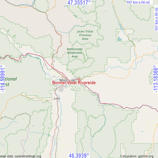
| Upper-left | 47.35517°, | -114.58991° |
| Center: | 46.87669°, | -113.88678° |
| Lower-right: | 46.3939°, | -113.18366° |
| Map W x H: | 106.9×106.9 km | = 66.4×66.4mi |
| max Lat: | 71.29058° ⇑3.6% North |
| Bonner-West Riverside: | 46.87669° |
| min Lat: | ⇓96.4% South 19.06759° |
| min Long | Bonner-West Riv | max Long |
| -171.73463° | -113.88678° | -66.98998° |
| W 11.6%⇐ | ⇒88.4% E |
Elevation
Elevation of Bonner-West Riverside is 1003 m = 3291 ft, and this is 708.2 m = 2323 ft above average elevation for this country.
| Max E: |
3189 m = 10463 ft | 6.6% |
| Bonner-West Riverside | 1003 m 3291 ft | |
| Avg. | 294.8 m = 967 ft | |
Min E: |
-60 m = -197 ft | 93.4% |
See also: United States elevation on elevation.city.
Geographical zone
Bonner-West Riverside is located in North temperate zone (between Tropic of Cancer and the Arctic Circle). Distance of this North polar circle is 2189 km =1360.2 mi to North.| Distance of | km | miles | from Bonner-West Riverside |
|---|---|---|---|
| North Pole | 4794.9 | 2979.4 | to North |
| Arctic Circle | 2189 | 1360.2 | to North |
| Tropic Cancer | 2606.3 | 1619.5 | to South |
| Equator | 5212.2 | 3238.7 | to South |


Nearby cities:
15 places around Bonner-West Riverside: (largest is in red/bold)
• Arlee
35.1 km =21.8 mi,  334°
334°
• Carlton
26.7 km =16.6 mi,  213°
213°
• Clinton
17.9 km =11.1 mi,  132°
132°
• Corvallis
64.9 km =40.3 mi,  195°
195°
• East Missoula
4.4 km =2.7 mi,  261°
261°
• Florence
30.9 km =19.2 mi, 208°
• Frenchtown
30.2 km =18.8 mi,  300°
300°
• Lolo
19.7 km =12.2 mi,  228°
228°
• Missoula
8.2 km =5.1 mi,  266°
266°
• Orchard Homes
12.4 km =7.7 mi, 263°
• Saint Ignatius
51.7 km =32.1 mi,  342°
342°
• Seeley Lake
45.4 km =28.2 mi,  42°
42°
• Stevensville
43.7 km =27.2 mi, 201°
• Victor
55 km =34.2 mi, 201°
• Wye
19.7 km =12.2 mi, 295°
Sources, notices
• [Note1] Compared only with cities in United States existing in our database
• [Src1] Map data: © OpenStreetMap contributors (CC-BY-SA)
• [Src2] Other city data from geonames.org with taken over terms of usage.
• [Src3] Geographical zone / Annual Mean Temperature by Robert A. Rohde @ Wikipedia
