Chappell geodata
Chappell (Nebraska) is a seat of a second-order administrative division; located in United States in America/Denver (GMT-6) time zone. With population of 921 people, there are 16858 cities with bigger population in this country. Compared to other cities in United States, 66.8% of cities are located further ↓South; 82.1% of cities are located further →East and 94.2% of cities have lower elevation than Chappell. Note1


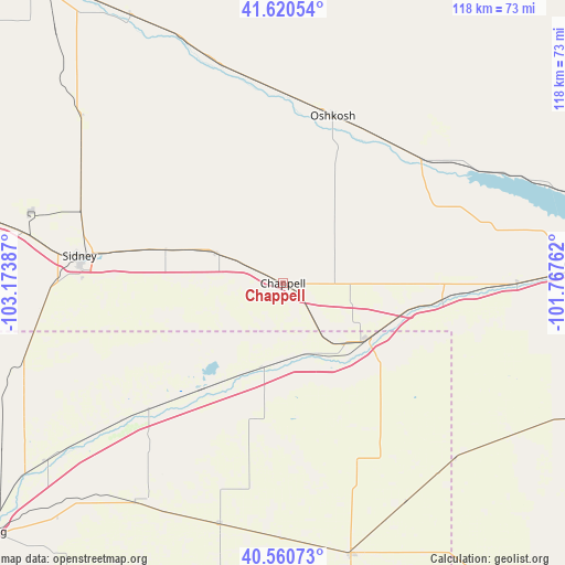
Chappell GPS coordinates[2]
41° 5' 33.972" North, 102° 28' 14.664" West
| Map corner | latitude | longitude |
|---|---|---|
| Upper-left | 41.62054°, | -103.17387° |
| Center: | 41.09277°, | -102.47074° |
| Lower-right: | 40.56073°, | -101.76762° |
| Map W x H: | 117.8×117.8 km | = 73.2×73.2mi |
| max Lat: | 71.29058° ⇑33.2% North |
| Chappell: | 41.09277° |
| min Lat: | ⇓66.8% South 19.06759° |
| min Long | Chappell | max Long |
| -171.73463° | -102.47074° | -66.98998° |
| W 17.9%⇐ | ⇒82.1% E |
Elevation
Elevation of Chappell is 1128 m = 3701 ft, and this is 833.2 m = 2734 ft above average elevation for this country.
| Max E: |
3189 m = 10463 ft | 5.8% |
| Chappell | 1128 m 3701 ft | |
| Avg. | 294.8 m = 967 ft | |
Min E: |
-60 m = -197 ft | 94.2% |
See also: United States elevation on elevation.city.
Geographical zone
Chappell is located in North temperate zone (between Tropic of Cancer and the Arctic Circle). Distance of this Northern Tropic circle is 1963.2 km =1219.9 mi to South.| Distance of | km | miles | from Chappell |
|---|---|---|---|
| North Pole | 5438 | 3379 | to North |
| Arctic Circle | 2832.1 | 1759.8 | to North |
| Tropic Cancer | 1963.2 | 1219.9 | to South |
| Equator | 4569.1 | 2839.1 | to South |


Nearby cities:
15 places around Chappell: (largest is in red/bold)
• Arthur
84.1 km =52.3 mi,  50°
50°
• Bayard
102.4 km =63.6 mi,  315°
315°
• Bridgeport
82.5 km =51.3 mi, 320°
• Grant
68.5 km =42.6 mi,  114°
114°
• Haxtun
51.9 km =32.2 mi,  194°
194°
• Holyoke
58.3 km =36.2 mi,  165°
165°
• Imperial
94.6 km =58.8 mi,  132°
132°
• Julesburg
20.8 km =12.9 mi,  123°
123°
• Kimball
101.1 km =62.8 mi,  279°
279°
• Ogallala
63 km =39.1 mi,  86°
86°
• Oshkosh
36.3 km =22.6 mi,  16°
16°
• Sidney
42.9 km =26.7 mi, 277°
• Sterling
80.9 km =50.3 mi,  230°
230°
• Sutherland
112.8 km =70.1 mi, 86°
• Yuma
110 km =68.4 mi, 191°
Sources, notices
• [Note1] Compared only with cities in United States existing in our database
• [Src1] Map data: © OpenStreetMap contributors (CC-BY-SA)
• [Src2] Other city data from geonames.org with taken over terms of usage.
• [Src3] Geographical zone / Annual Mean Temperature by Robert A. Rohde @ Wikipedia
