Sutherland geodata
Sutherland (Nebraska) is a populated place; located in United States in America/Chicago (GMT-5) time zone. With population of 1,336 people, there are 14408 cities with bigger population in this country. Compared to other cities in United States, 67.4% of cities are located further ↓South; 81.4% of cities are located further →East and 92.8% of cities have lower elevation than Sutherland. Note1


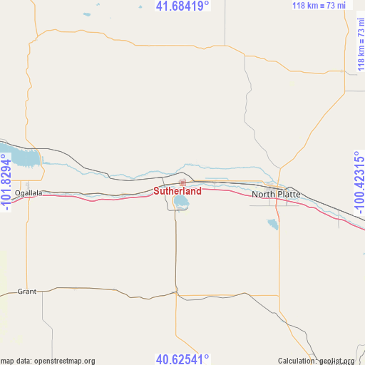
Sutherland GPS coordinates[2]
41° 9' 24.984" North, 101° 7' 34.572" West
| Map corner | latitude | longitude |
|---|---|---|
| Upper-left | 41.68419°, | -101.8294° |
| Center: | 41.15694°, | -101.12627° |
| Lower-right: | 40.62541°, | -100.42315° |
| Map W x H: | 117.7×117.7 km | = 73.1×73.1mi |
| max Lat: | 71.29058° ⇑32.6% North |
| Sutherland: | 41.15694° |
| min Lat: | ⇓67.4% South 19.06759° |
| min Long | Sutherland | max Long |
| -171.73463° | -101.12627° | -66.98998° |
| W 18.6%⇐ | ⇒81.4% E |
Elevation
Elevation of Sutherland is 904 m = 2966 ft, and this is 609.2 m = 1999 ft above average elevation for this country.
| Max E: |
3189 m = 10463 ft | 7.2% |
| Sutherland | 904 m 2966 ft | |
| Avg. | 294.8 m = 967 ft | |
Min E: |
-60 m = -197 ft | 92.8% |
See also: United States elevation on elevation.city.
Geographical zone
Sutherland is located in North temperate zone (between Tropic of Cancer and the Arctic Circle). Distance of this Northern Tropic circle is 1970.3 km =1224.3 mi to South.| Distance of | km | miles | from Sutherland |
|---|---|---|---|
| North Pole | 5430.8 | 3374.5 | to North |
| Arctic Circle | 2825 | 1755.4 | to North |
| Tropic Cancer | 1970.3 | 1224.3 | to South |
| Equator | 4576.2 | 2843.5 | to South |


Nearby cities:
15 places around Sutherland: (largest is in red/bold)
• Arnold
83.3 km =51.8 mi,  69°
69°
• Arthur
66 km =41 mi,  314°
314°
• Curtis
77.9 km =48.4 mi,  138°
138°
• Gothenburg
84.8 km =52.7 mi,  107°
107°
• Grant
61.3 km =38.1 mi,  235°
235°
• Hayes Center
72.4 km =45 mi,  172°
172°
• Hershey
10.4 km =6.5 mi,  88°
88°
• Imperial
83.4 km =51.8 mi,  211°
211°
• Julesburg
97.2 km =60.4 mi,  258°
258°
• North Platte
30.4 km =18.9 mi,  96°
96°
• Ogallala
49.8 km =30.9 mi,  266°
266°
• Stapleton
62.6 km =38.9 mi,  54°
54°
• Stockville
93.4 km =58 mi, 138°
• Tryon
46.2 km =28.7 mi,  17°
17°
• Wauneta
84.7 km =52.6 mi,  194°
194°
Sources, notices
• [Note1] Compared only with cities in United States existing in our database
• [Src1] Map data: © OpenStreetMap contributors (CC-BY-SA)
• [Src2] Other city data from geonames.org with taken over terms of usage.
• [Src3] Geographical zone / Annual Mean Temperature by Robert A. Rohde @ Wikipedia
