Arthur geodata
Arthur (Nebraska) is a seat of a second-order administrative division; located in United States in America/Denver (GMT-6) time zone. With population of 117 people, there are 21034 cities with bigger population in this country. Compared to other cities in United States, 71.6% of cities are located further ↓South; 81.7% of cities are located further →East and 94.1% of cities have lower elevation than Arthur. Note1


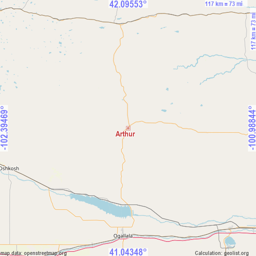
Arthur GPS coordinates[2]
41° 34' 17.94" North, 101° 41' 29.616" West
| Map corner | latitude | longitude |
|---|---|---|
| Upper-left | 42.09553°, | -102.39469° |
| Center: | 41.57165°, | -101.69156° |
| Lower-right: | 41.04348°, | -100.98844° |
| Map W x H: | 117×117 km | = 72.7×72.7mi |
| max Lat: | 71.29058° ⇑28.4% North |
| Arthur: | 41.57165° |
| min Lat: | ⇓71.6% South 19.06759° |
| min Long | Arthur | max Long |
| -171.73463° | -101.69156° | -66.98998° |
| W 18.3%⇐ | ⇒81.7% E |
Elevation
Elevation of Arthur is 1112 m = 3648 ft, and this is 817.2 m = 2681 ft above average elevation for this country.
| Max E: |
3189 m = 10463 ft | 5.9% |
| Arthur | 1112 m 3648 ft | |
| Avg. | 294.8 m = 967 ft | |
Min E: |
-60 m = -197 ft | 94.1% |
See also: United States elevation on elevation.city.
Geographical zone
Arthur is located in North temperate zone (between Tropic of Cancer and the Arctic Circle). Distance of this Northern Tropic circle is 2016.4 km =1252.9 mi to South.| Distance of | km | miles | from Arthur |
|---|---|---|---|
| North Pole | 5384.7 | 3345.9 | to North |
| Arctic Circle | 2778.8 | 1726.7 | to North |
| Tropic Cancer | 2016.4 | 1252.9 | to South |
| Equator | 4622.3 | 2872.2 | to South |


Nearby cities:
15 places around Arthur: (largest is in red/bold)
• Alliance
114.2 km =71 mi,  301°
301°
• Chappell
84.1 km =52.3 mi,  230°
230°
• Grant
81.2 km =50.5 mi,  181°
181°
• Hershey
73.6 km =45.7 mi,  128°
128°
• Hyannis
48 km =29.8 mi,  353°
353°
• Imperial
117.3 km =72.9 mi, 178°
• Julesburg
80.6 km =50.1 mi,  216°
216°
• Mullen
75.1 km =46.7 mi,  45°
45°
• North Platte
91.9 km =57.1 mi,  122°
122°
• Ogallala
49.4 km =30.7 mi, 182°
• Oshkosh
57.4 km =35.7 mi,  251°
251°
• Stapleton
98.6 km =61.3 mi,  95°
95°
• Sutherland
66 km =41 mi, 134°
• Thedford
102.9 km =63.9 mi,  63°
63°
• Tryon
61.1 km =38 mi,  91°
91°
Sources, notices
• [Note1] Compared only with cities in United States existing in our database
• [Src1] Map data: © OpenStreetMap contributors (CC-BY-SA)
• [Src2] Other city data from geonames.org with taken over terms of usage.
• [Src3] Geographical zone / Annual Mean Temperature by Robert A. Rohde @ Wikipedia
