Carnation geodata
Carnation (Washington) is a populated place; located in United States in America/Los_Angeles (GMT-7) time zone. With population of 1,873 people, there are 12301 cities with bigger population in this country. Compared to other cities in United States, 98% of cities are located further ↓South; 94.8% of cities are located further →East and 87% of cities have higher elevation than Carnation. Note1


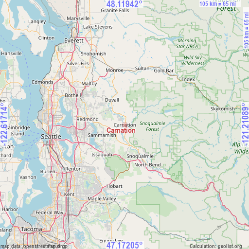
Carnation GPS coordinates[2]
47° 38' 52.368" North, 121° 54' 50.436" West
| Map corner | latitude | longitude |
|---|---|---|
| Upper-left | 48.11942°, | -122.61714° |
| Center: | 47.64788°, | -121.91401° |
| Lower-right: | 47.17205°, | -121.21089° |
| Map W x H: | 105.3×105.3 km | = 65.4×65.4mi |
| max Lat: | 71.29058° ⇑2% North |
| Carnation: | 47.64788° |
| min Lat: | ⇓98% South 19.06759° |
| min Long | Carnation | max Long |
| -171.73463° | -121.91401° | -66.98998° |
| W 5.2%⇐ | ⇒94.8% E |
Elevation
Elevation of Carnation is 23 m = 75 ft, and this is 271.8 m = 892 ft below average elevation for this country.
| Max E: |
3189 m = 10463 ft | 87% |
| Avg. | 294.8 m = 967 ft | |
| Carnation | 23 m = 75 ft | |
Min E: |
-60 m = -197 ft | 13% |
See also: United States elevation on elevation.city.
Geographical zone
Carnation is located in North temperate zone (between Tropic of Cancer and the Arctic Circle). Distance of this North polar circle is 2103.2 km =1306.9 mi to North.| Distance of | km | miles | from Carnation |
|---|---|---|---|
| North Pole | 4709.1 | 2926.1 | to North |
| Arctic Circle | 2103.2 | 1306.9 | to North |
| Tropic Cancer | 2692 | 1672.7 | to South |
| Equator | 5297.9 | 3292 | to South |


Nearby cities:
15 places around Carnation: (largest is in red/bold)
• Ames Lake
4.3 km =2.7 mi,  246°
246°
• City of Sammamish
10.5 km =6.5 mi,  242°
242°
• Cottage Lake
16.3 km =10.1 mi,  311°
311°
• Duvall
11.8 km =7.3 mi,  332°
332°
• Eastgate
19.3 km =12 mi, 244°
• Echo Lake
18.1 km =11.2 mi, 326°
• Fall City
9.2 km =5.7 mi,  168°
168°
• Issaquah
15.8 km =9.8 mi,  214°
214°
• Klahanie
11.1 km =6.9 mi,  219°
219°
• Lake Marcel-Stillwater
5 km =3.1 mi,  359°
359°
• Redmond
15.8 km =9.8 mi,  280°
280°
• Sammamish
12.5 km =7.8 mi,  266°
266°
• Snoqualmie
14.8 km =9.2 mi,  153°
153°
• Union Hill-Novelty Hill
9.2 km =5.7 mi,  291°
291°
• West Lake Sammamish
16.1 km =10 mi, 240°
Sources, notices
• [Note1] Compared only with cities in United States existing in our database
• [Src1] Map data: © OpenStreetMap contributors (CC-BY-SA)
• [Src2] Other city data from geonames.org with taken over terms of usage.
• [Src3] Geographical zone / Annual Mean Temperature by Robert A. Rohde @ Wikipedia
