Union Hill-Novelty Hill geodata
Union Hill-Novelty Hill (Washington) is a populated place; located in United States in America/Los_Angeles (GMT-7) time zone. With population of 18,805 people, there are 2680 cities with bigger population in this country. Compared to other cities in United States, 98% of cities are located further ↓South; 95.1% of cities are located further →East and 55.3% of cities have higher elevation than Union Hill-Novelty Hill. Note1
Current local time in Union Hill-Novelty Hill:
07:23 PM, TuesdayDifference from your time zone: hours


Union Hill-Novelty Hill GPS coordinates[2]
47° 40' 43.932" North, 122° 1' 41.988" West
| Map corner | latitude | longitude |
|---|---|---|
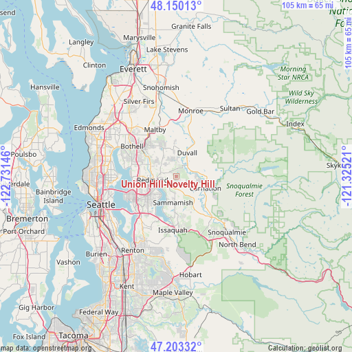
| Upper-left | 48.15013°, | -122.73146° |
| Center: | 47.67887°, | -122.02833° |
| Lower-right: | 47.20332°, | -121.32521° |
| Map W x H: | 105.3×105.3 km | = 65.4×65.4mi |
| max Lat: | 71.29058° ⇑2% North |
| Union Hill-Novelty Hill: | 47.67887° |
| min Lat: | ⇓98% South 19.06759° |
| min Long | Union Hill-Nove | max Long |
| -171.73463° | -122.02833° | -66.98998° |
| W 4.9%⇐ | ⇒95.1% E |
Elevation
Elevation of Union Hill-Novelty Hill is 179 m = 587 ft, and this is 115.8 m = 380 ft below average elevation for this country.
| Max E: |
3189 m = 10463 ft | 55.3% |
| Avg. | 294.8 m = 967 ft | |
| Union Hill-Novelty Hill | 179 m = 587 ft | |
Min E: |
-60 m = -197 ft | 44.7% |
See also: United States elevation on elevation.city.
Geographical zone
Union Hill-Novelty Hill is located in North temperate zone (between Tropic of Cancer and the Arctic Circle). Distance of this North polar circle is 2099.8 km =1304.8 mi to North.| Distance of | km | miles | from Union Hill-Novelty Hill |
|---|---|---|---|
| North Pole | 4705.7 | 2924 | to North |
| Arctic Circle | 2099.8 | 1304.8 | to North |
| Tropic Cancer | 2695.5 | 1674.9 | to South |
| Equator | 5301.4 | 3294.1 | to South |


Nearby cities:
15 places around Union Hill-Novelty Hill: (largest is in red/bold)
• Ames Lake
6.9 km =4.3 mi,  137°
137°
• Carnation
9.2 km =5.7 mi,  111°
111°
• City of Sammamish
8.3 km =5.2 mi,  184°
184°
• Cottage Lake
8.1 km =5 mi,  333°
333°
• Duvall
7.7 km =4.8 mi,  24°
24°
• Echo Lake
11.8 km =7.3 mi,  353°
353°
• Kingsgate
12.5 km =7.8 mi,  295°
295°
• Kirkland
13.5 km =8.4 mi,  271°
271°
• Klahanie
12.1 km =7.5 mi,  172°
172°
• Lake Marcel-Stillwater
8.6 km =5.3 mi,  79°
79°
• Redmond
7 km =4.3 mi, 265°
• Sammamish
5.7 km =3.5 mi,  223°
223°
• West Lake Sammamish
12.5 km =7.8 mi,  205°
205°
• Woodinville
13.1 km =8.1 mi,  309°
309°
• Yarrow Point
14.6 km =9.1 mi,  255°
255°
Sources, notices
• [Note1] Compared only with cities in United States existing in our database
• [Src1] Map data: © OpenStreetMap contributors (CC-BY-SA)
• [Src2] Other city data from geonames.org with taken over terms of usage.
• [Src3] Geographical zone / Annual Mean Temperature by Robert A. Rohde @ Wikipedia
