Colfax geodata
Colfax (Washington) is a seat of a second-order administrative division; located in United States in America/Los_Angeles (GMT-7) time zone. With population of 2,870 people, there are 9873 cities with bigger population in this country. Compared to other cities in United States, 96.4% of cities are located further ↓South; 90.3% of cities are located further →East and 89.7% of cities have lower elevation than Colfax. Note1


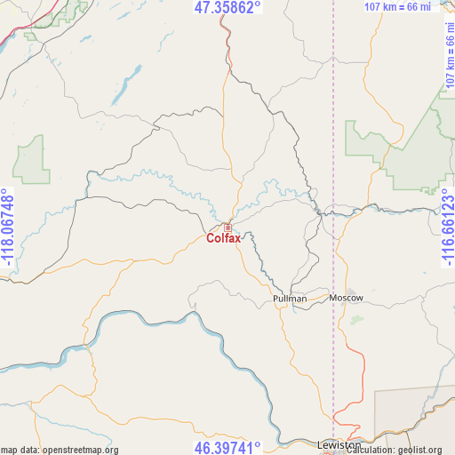
Colfax GPS coordinates[2]
46° 52' 48.612" North, 117° 21' 51.66" West
| Map corner | latitude | longitude |
|---|---|---|
| Upper-left | 47.35862°, | -118.06748° |
| Center: | 46.88017°, | -117.36435° |
| Lower-right: | 46.39741°, | -116.66123° |
| Map W x H: | 106.9×106.9 km | = 66.4×66.4mi |
| max Lat: | 71.29058° ⇑3.6% North |
| Colfax: | 46.88017° |
| min Lat: | ⇓96.4% South 19.06759° |
| min Long | Colfax | max Long |
| -171.73463° | -117.36435° | -66.98998° |
| W 9.7%⇐ | ⇒90.3% E |
Elevation
Elevation of Colfax is 602 m = 1975 ft, and this is 307.2 m = 1008 ft above average elevation for this country.
| Max E: |
3189 m = 10463 ft | 10.3% |
| Colfax | 602 m 1975 ft | |
| Avg. | 294.8 m = 967 ft | |
Min E: |
-60 m = -197 ft | 89.7% |
See also: United States elevation on elevation.city.
Geographical zone
Colfax is located in North temperate zone (between Tropic of Cancer and the Arctic Circle). Distance of this North polar circle is 2188.6 km =1359.9 mi to North.| Distance of | km | miles | from Colfax |
|---|---|---|---|
| North Pole | 4794.5 | 2979.2 | to North |
| Arctic Circle | 2188.6 | 1359.9 | to North |
| Tropic Cancer | 2606.7 | 1619.7 | to South |
| Equator | 5212.6 | 3239 | to South |


Nearby cities:
15 places around Colfax: (largest is in red/bold)
• Albion
13.2 km =8.2 mi,  138°
138°
• Clarkston
57 km =35.4 mi,  154°
154°
• Garfield
22.1 km =13.7 mi,  50°
50°
• Genesee
49.6 km =30.8 mi, 137°
• Lewiston
57.9 km =36 mi, 152°
• Moscow
32.2 km =20 mi,  120°
120°
• Palouse
22.2 km =13.8 mi,  81°
81°
• Pomeroy
48.6 km =30.2 mi,  201°
201°
• Potlatch
35.7 km =22.2 mi, 82°
• Pullman
21.7 km =13.5 mi, 139°
• Rosalia
39.6 km =24.6 mi,  359°
359°
• Saint John
28.7 km =17.8 mi,  324°
324°
• Tekoa
44.1 km =27.4 mi,  30°
30°
• Troy
48 km =29.8 mi,  109°
109°
• West Clarkston-Highland
57.8 km =35.9 mi,  156°
156°
Sources, notices
• [Note1] Compared only with cities in United States existing in our database
• [Src1] Map data: © OpenStreetMap contributors (CC-BY-SA)
• [Src2] Other city data from geonames.org with taken over terms of usage.
• [Src3] Geographical zone / Annual Mean Temperature by Robert A. Rohde @ Wikipedia
