Naches geodata
Naches (Washington) is a populated place; located in United States in America/Los_Angeles (GMT-7) time zone. With population of 805 people, there are 17765 cities with bigger population in this country. Compared to other cities in United States, 96.2% of cities are located further ↓South; 93.5% of cities are located further →East and 86.2% of cities have lower elevation than Naches. Note1


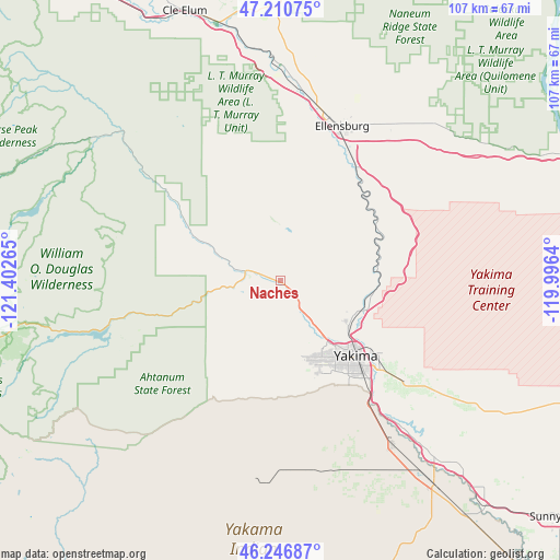
Naches GPS coordinates[2]
46° 43' 51.456" North, 120° 41' 58.272" West
| Map corner | latitude | longitude |
|---|---|---|
| Upper-left | 47.21075°, | -121.40265° |
| Center: | 46.73096°, | -120.69952° |
| Lower-right: | 46.24687°, | -119.9964° |
| Map W x H: | 107.2×107.2 km | = 66.6×66.6mi |
| max Lat: | 71.29058° ⇑3.8% North |
| Naches: | 46.73096° |
| min Lat: | ⇓96.2% South 19.06759° |
| min Long | Naches | max Long |
| -171.73463° | -120.69952° | -66.98998° |
| W 6.5%⇐ | ⇒93.5% E |
Elevation
Elevation of Naches is 448 m = 1470 ft, and this is 153.2 m = 503 ft above average elevation for this country.
| Max E: |
3189 m = 10463 ft | 13.8% |
| Naches | 448 m 1470 ft | |
| Avg. | 294.8 m = 967 ft | |
Min E: |
-60 m = -197 ft | 86.2% |
See also: United States elevation on elevation.city.
Geographical zone
Naches is located in North temperate zone (between Tropic of Cancer and the Arctic Circle). Distance of this North polar circle is 2205.2 km =1370.2 mi to North.| Distance of | km | miles | from Naches |
|---|---|---|---|
| North Pole | 4811.1 | 2989.5 | to North |
| Arctic Circle | 2205.2 | 1370.2 | to North |
| Tropic Cancer | 2590.1 | 1609.4 | to South |
| Equator | 5196 | 3228.6 | to South |


Nearby cities:
15 places around Naches: (largest is in red/bold)
• Ahtanum
20 km =12.4 mi,  162°
162°
• Ellensburg
31.7 km =19.7 mi,  21°
21°
• Gleed
10.4 km =6.5 mi,  140°
140°
• Harrah
38.2 km =23.7 mi, 161°
• Kittitas
35.3 km =21.9 mi,  37°
37°
• Moxee City
31.2 km =19.4 mi,  129°
129°
• Selah
15.5 km =9.6 mi,  123°
123°
• Summitview
15.6 km =9.7 mi, 163°
• Terrace Heights
24.2 km =15 mi, 124°
• Tieton
5.3 km =3.3 mi,  232°
232°
• Union Gap
25.8 km =16 mi, 138°
• Wapato
38 km =23.6 mi,  145°
145°
• West Valley
17 km =10.6 mi, 154°
• White Swan
38.8 km =24.1 mi,  183°
183°
• Yakima
20.6 km =12.8 mi, 134°
Sources, notices
• [Note1] Compared only with cities in United States existing in our database
• [Src1] Map data: © OpenStreetMap contributors (CC-BY-SA)
• [Src2] Other city data from geonames.org with taken over terms of usage.
• [Src3] Geographical zone / Annual Mean Temperature by Robert A. Rohde @ Wikipedia
