Shelton geodata
Shelton (Washington) is a seat of a second-order administrative division; located in United States in America/Los_Angeles (GMT-7) time zone. With population of 9,834 people, there are 4515 cities with bigger population in this country. Compared to other cities in United States, 97% of cities are located further ↓South; 98% of cities are located further →East and 97.4% of cities have higher elevation than Shelton. Note1


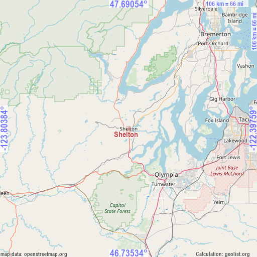
Shelton GPS coordinates[2]
47° 12' 54.324" North, 123° 6' 2.556" West
| Map corner | latitude | longitude |
|---|---|---|
| Upper-left | 47.69054°, | -123.80384° |
| Center: | 47.21509°, | -123.10071° |
| Lower-right: | 46.73534°, | -122.39759° |
| Map W x H: | 106.2×106.2 km | = 66×66mi |
| max Lat: | 71.29058° ⇑3% North |
| Shelton: | 47.21509° |
| min Lat: | ⇓97% South 19.06759° |
| min Long | Shelton | max Long |
| -171.73463° | -123.10071° | -66.98998° |
| W 2%⇐ | ⇒98% E |
Elevation
Elevation of Shelton is 6 m = 20 ft, and this is 288.8 m = 948 ft below average elevation for this country.
| Max E: |
3189 m = 10463 ft | 97.4% |
| Avg. | 294.8 m = 967 ft | |
| Shelton | 6 m = 20 ft | |
Min E: |
-60 m = -197 ft | 2.6% |
See also: United States elevation on elevation.city.
Geographical zone
Shelton is located in North temperate zone (between Tropic of Cancer and the Arctic Circle). Distance of this North polar circle is 2151.3 km =1336.8 mi to North.| Distance of | km | miles | from Shelton |
|---|---|---|---|
| North Pole | 4757.2 | 2956 | to North |
| Arctic Circle | 2151.3 | 1336.8 | to North |
| Tropic Cancer | 2643.9 | 1642.8 | to South |
| Equator | 5249.8 | 3262.1 | to South |


Nearby cities:
15 places around Shelton: (largest is in red/bold)
• Allyn
28 km =17.4 mi,  47°
47°
• Elma
33.1 km =20.6 mi,  224°
224°
• Grapeview
23.9 km =14.9 mi,  57°
57°
• Home
26.3 km =16.3 mi,  75°
75°
• Key Center
30.2 km =18.8 mi, 62°
• Lacey
29.1 km =18.1 mi,  133°
133°
• Longbranch
26 km =16.2 mi,  91°
91°
• McCleary
21.9 km =13.6 mi,  214°
214°
• Olympia
24.8 km =15.4 mi,  142°
142°
• Skokomish
13.8 km =8.6 mi,  342°
342°
• Tanglewilde
30.2 km =18.8 mi, 127°
• Tanglewilde-Thompson Place
30.3 km =18.8 mi, 126°
• Tumwater
27.3 km =17 mi,  147°
147°
• Union
15.6 km =9.7 mi,  359°
359°
• Vaughn
29.2 km =18.1 mi, 60°
Sources, notices
• [Note1] Compared only with cities in United States existing in our database
• [Src1] Map data: © OpenStreetMap contributors (CC-BY-SA)
• [Src2] Other city data from geonames.org with taken over terms of usage.
• [Src3] Geographical zone / Annual Mean Temperature by Robert A. Rohde @ Wikipedia
