South Cle Elum geodata
South Cle Elum (Washington) is a populated place; located in United States in America/Los_Angeles (GMT-7) time zone. With population of 536 people, there are 20440 cities with bigger population in this country. Compared to other cities in United States, 96.9% of cities are located further ↓South; 93.7% of cities are located further →East and 89.4% of cities have lower elevation than South Cle Elum. Note1


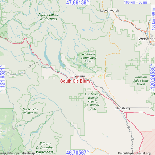
South Cle Elum GPS coordinates[2]
47° 11' 8.448" North, 120° 56' 56.292" West
| Map corner | latitude | longitude |
|---|---|---|
| Upper-left | 47.66139°, | -121.6521° |
| Center: | 47.18568°, | -120.94897° |
| Lower-right: | 46.70567°, | -120.24585° |
| Map W x H: | 106.3×106.3 km | = 66.1×66.1mi |
| max Lat: | 71.29058° ⇑3.1% North |
| South Cle Elum: | 47.18568° |
| min Lat: | ⇓96.9% South 19.06759° |
| min Long | South Cle Elum | max Long |
| -171.73463° | -120.94897° | -66.98998° |
| W 6.3%⇐ | ⇒93.7% E |
Elevation
Elevation of South Cle Elum is 586 m = 1923 ft, and this is 291.2 m = 955 ft above average elevation for this country.
| Max E: |
3189 m = 10463 ft | 10.6% |
| South Cle Elum | 586 m 1923 ft | |
| Avg. | 294.8 m = 967 ft | |
Min E: |
-60 m = -197 ft | 89.4% |
See also: United States elevation on elevation.city.
Geographical zone
South Cle Elum is located in North temperate zone (between Tropic of Cancer and the Arctic Circle). Distance of this North polar circle is 2154.6 km =1338.8 mi to North.| Distance of | km | miles | from South Cle Elum |
|---|---|---|---|
| North Pole | 4760.5 | 2958 | to North |
| Arctic Circle | 2154.6 | 1338.8 | to North |
| Tropic Cancer | 2640.6 | 1640.8 | to South |
| Equator | 5246.6 | 3260.1 | to South |


Nearby cities:
15 places around South Cle Elum: (largest is in red/bold)
• Cashmere
52 km =32.3 mi,  43°
43°
• Cle Elum
1.3 km =0.8 mi,  34°
34°
• East Wenatchee
55.7 km =34.6 mi,  62°
62°
• East Wenatchee Bench
57 km =35.4 mi, 62°
• Ellensburg
36.9 km =22.9 mi,  124°
124°
• Gleed
63.9 km =39.7 mi,  156°
156°
• Kittitas
46.1 km =28.6 mi, 119°
• Leavenworth
50.5 km =31.4 mi, 25°
• Naches
54 km =33.6 mi, 159°
• Roslyn
5.4 km =3.4 mi,  321°
321°
• South Wenatchee
54.7 km =34 mi,  65°
65°
• Sunnyslope
56.1 km =34.9 mi, 55°
• Tieton
55.7 km =34.6 mi, 164°
• Wenatchee
54.9 km =34.1 mi, 61°
• West Wenatchee
53.3 km =33.1 mi, 57°
Sources, notices
• [Note1] Compared only with cities in United States existing in our database
• [Src1] Map data: © OpenStreetMap contributors (CC-BY-SA)
• [Src2] Other city data from geonames.org with taken over terms of usage.
• [Src3] Geographical zone / Annual Mean Temperature by Robert A. Rohde @ Wikipedia
