Powell geodata
Powell (Wyoming) is a populated place; located in United States in America/Denver (GMT-6) time zone. With population of 6,462 people, there are 6132 cities with bigger population in this country. Compared to other cities in United States, 91.4% of cities are located further ↓South; 85.3% of cities are located further →East and 95.5% of cities have lower elevation than Powell. Note1


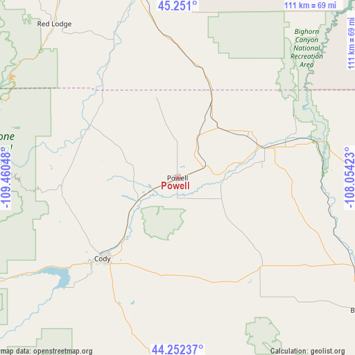
Powell GPS coordinates[2]
44° 45' 13.824" North, 108° 45' 26.46" West
| Map corner | latitude | longitude |
|---|---|---|
| Upper-left | 45.251°, | -109.46048° |
| Center: | 44.75384°, | -108.75735° |
| Lower-right: | 44.25237°, | -108.05423° |
| Map W x H: | 111×111 km | = 69×69mi |
| max Lat: | 71.29058° ⇑8.6% North |
| Powell: | 44.75384° |
| min Lat: | ⇓91.4% South 19.06759° |
| min Long | Powell | max Long |
| -171.73463° | -108.75735° | -66.98998° |
| W 14.7%⇐ | ⇒85.3% E |
Elevation
Elevation of Powell is 1340 m = 4396 ft, and this is 1045.2 m = 3429 ft above average elevation for this country.
| Max E: |
3189 m = 10463 ft | 4.5% |
| Powell | 1340 m 4396 ft | |
| Avg. | 294.8 m = 967 ft | |
Min E: |
-60 m = -197 ft | 95.5% |
See also: United States elevation on elevation.city.
Geographical zone
Powell is located in North temperate zone (between Tropic of Cancer and the Arctic Circle). Distance of this Northern Tropic circle is 2370.2 km =1472.8 mi to South.| Distance of | km | miles | from Powell |
|---|---|---|---|
| North Pole | 5030.9 | 3126.1 | to North |
| Arctic Circle | 2425 | 1506.8 | to North |
| Tropic Cancer | 2370.2 | 1472.8 | to South |
| Equator | 4976.2 | 3092.1 | to South |


Nearby cities:
15 places around Powell: (largest is in red/bold)
• Absarokee
100.8 km =62.6 mi,  327°
327°
• Basin
70.5 km =43.8 mi,  126°
126°
• Bridger
61.5 km =38.2 mi,  348°
348°
• Byron
20.4 km =12.7 mi,  76°
76°
• Cody
34.6 km =21.5 mi,  223°
223°
• Cowley
26.9 km =16.7 mi,  57°
57°
• Greybull
62.8 km =39 mi,  117°
117°
• Joliet
83 km =51.6 mi, 348°
• Laurel
101.8 km =63.3 mi,  359°
359°
• Lovell
30.5 km =19 mi,  72°
72°
• Park City
98.5 km =61.2 mi, 352°
• Pryor
77.2 km =48 mi,  13°
13°
• Red Lodge
61.6 km =38.3 mi,  321°
321°
• Washakie Ten
99.5 km =61.8 mi,  137°
137°
• Worland
103.8 km =64.5 mi, 142°
Sources, notices
• [Note1] Compared only with cities in United States existing in our database
• [Src1] Map data: © OpenStreetMap contributors (CC-BY-SA)
• [Src2] Other city data from geonames.org with taken over terms of usage.
• [Src3] Geographical zone / Annual Mean Temperature by Robert A. Rohde @ Wikipedia
