Waimalu geodata
Waimalu (Hawaii) is a populated place; located in United States in Pacific/Honolulu (GMT-10) time zone. With population of 13,730 people, there are 3496 cities with bigger population in this country. Compared to other cities in United States, 99.6% of cities are located further ↑North; 99.6% of cities are located further →East and 66.4% of cities have higher elevation than Waimalu. Note1


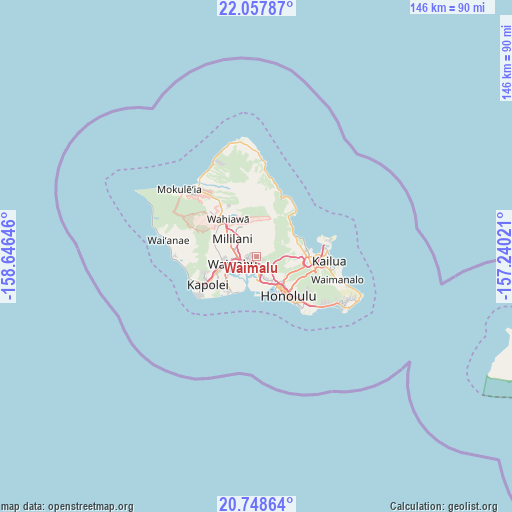
Waimalu GPS coordinates[2]
21° 24' 16.992" North, 157° 56' 35.988" West
| Map corner | latitude | longitude |
|---|---|---|
| Upper-left | 22.05787°, | -158.64646° |
| Center: | 21.40472°, | -157.94333° |
| Lower-right: | 20.74864°, | -157.24021° |
| Map W x H: | 145.6×145.6 km | = 90.5×90.5mi |
| max Lat: | 71.29058° ⇑99.6% North |
| Waimalu: | 21.40472° |
| min Lat: | ⇓0.4% South 19.06759° |
| min Long | Waimalu | max Long |
| -171.73463° | -157.94333° | -66.98998° |
| W 0.4%⇐ | ⇒99.6% E |
Elevation
Elevation of Waimalu is 121 m = 397 ft, and this is 173.8 m = 570 ft below average elevation for this country.
| Max E: |
3189 m = 10463 ft | 66.4% |
| Avg. | 294.8 m = 967 ft | |
| Waimalu | 121 m = 397 ft | |
Min E: |
-60 m = -197 ft | 33.6% |
See also: United States elevation on elevation.city.
Geographical zone
Waimalu is located in North Torrid zone (between Equator and Tropic of Cancer). Distance of this Northern Tropic circle is 225.9 km =140.4 mi to North.| Distance of | km | miles | from Waimalu |
|---|---|---|---|
| North Pole | 7627.1 | 4739.3 | to North |
| Arctic Circle | 5021.2 | 3120 | to North |
| Tropic Cancer | 225.9 | 140.4 | to North |
| Equator | 2380 | 1478.9 | to South |


Nearby cities:
15 places around Waimalu: (largest is in red/bold)
• Hickam Field
7.4 km =4.6 mi,  193°
193°
• Hālawa
3.6 km =2.2 mi,  141°
141°
• Hālawa Heights
4.2 km =2.6 mi,  133°
133°
• Iroquois Point
9.5 km =5.9 mi,  205°
205°
• Kahalu‘u
11.8 km =7.3 mi,  60°
60°
• Mililani Town
7.8 km =4.8 mi,  310°
310°
• Pearl City
3.4 km =2.1 mi,  256°
256°
• Royal Kunia
8.7 km =5.4 mi, 262°
• Village Park
9 km =5.6 mi,  265°
265°
• Waipahu
7.1 km =4.4 mi,  253°
253°
• Waipio
6 km =3.7 mi,  284°
284°
• Waipi‘o Acres
9.9 km =6.2 mi, 312°
• ‘Aiea
2.7 km =1.7 mi,  158°
158°
• ‘Ewa Gentry
11.5 km =7.1 mi,  231°
231°
• ‘Āhuimanu
11.8 km =7.3 mi,  67°
67°
Sources, notices
• [Note1] Compared only with cities in United States existing in our database
• [Src1] Map data: © OpenStreetMap contributors (CC-BY-SA)
• [Src2] Other city data from geonames.org with taken over terms of usage.
• [Src3] Geographical zone / Annual Mean Temperature by Robert A. Rohde @ Wikipedia
