Waipi‘o Acres geodata
Waipi‘o Acres (Hawaii) is a populated place; located in United States in Pacific/Honolulu (GMT-10) time zone. With population of 5,236 people, there are 6962 cities with bigger population in this country. Compared to other cities in United States, 99.5% of cities are located further ↑North; 99.6% of cities are located further →East and 53% of cities have lower elevation than Waipi‘o Acres. Note1


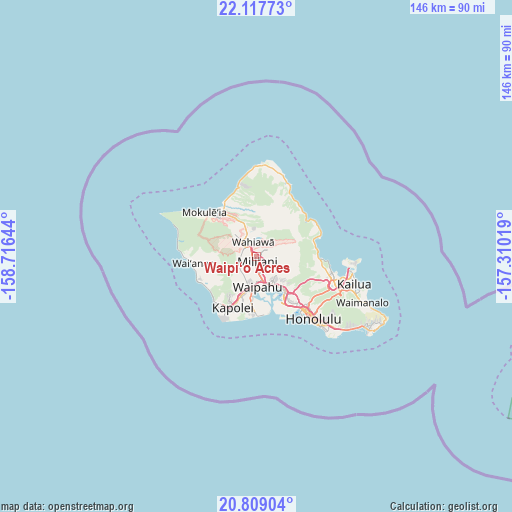
Waipi‘o Acres GPS coordinates[2]
21° 27' 53.46" North, 158° 0' 47.916" West
| Map corner | latitude | longitude |
|---|---|---|
| Upper-left | 22.11773°, | -158.71644° |
| Center: | 21.46485°, | -158.01331° |
| Lower-right: | 20.80904°, | -157.31019° |
| Map W x H: | 145.5×145.5 km | = 90.4×90.4mi |
| max Lat: | 71.29058° ⇑99.5% North |
| Waipi‘o Acres: | 21.46485° |
| min Lat: | ⇓0.5% South 19.06759° |
| min Long | Waipi‘o Acres | max Long |
| -171.73463° | -158.01331° | -66.98998° |
| W 0.4%⇐ | ⇒99.6% E |
Elevation
Elevation of Waipi‘o Acres is 210 m = 689 ft, and this is 84.8 m = 278 ft below average elevation for this country.
| Max E: |
3189 m = 10463 ft | 47% |
| Avg. | 294.8 m = 967 ft | |
| Waipi‘o Acres | 210 m = 689 ft | |
Min E: |
-60 m = -197 ft | 53% |
See also: United States elevation on elevation.city.
Geographical zone
Waipi‘o Acres is located in North Torrid zone (between Equator and Tropic of Cancer). Distance of this Northern Tropic circle is 219.3 km =136.3 mi to North.| Distance of | km | miles | from Waipi‘o Acres |
|---|---|---|---|
| North Pole | 7620.4 | 4735.1 | to North |
| Arctic Circle | 5014.5 | 3115.9 | to North |
| Tropic Cancer | 219.3 | 136.3 | to North |
| Equator | 2386.7 | 1483 | to South |


Nearby cities:
15 places around Waipi‘o Acres: (largest is in red/bold)
• Hālawa
13.4 km =8.3 mi,  135°
135°
• Hālawa Heights
14.1 km =8.8 mi,  133°
133°
• Mililani Town
2.1 km =1.3 mi, 142°
• Pearl City
8.5 km =5.3 mi,  152°
152°
• Royal Kunia
8 km =5 mi,  189°
189°
• Schofield Barracks
6.5 km =4 mi,  304°
304°
• Village Park
7.6 km =4.7 mi, 193°
• Wahiawā
4.4 km =2.7 mi,  344°
344°
• Waimalu
9.9 km =6.2 mi, 132°
• Waipahu
8.7 km =5.4 mi,  177°
177°
• Waipio
5.4 km =3.4 mi,  164°
164°
• Whitmore Village
5.6 km =3.5 mi,  347°
347°
• ‘Aiea
12.3 km =7.6 mi, 138°
• ‘Ewa Gentry
14 km =8.7 mi, 187°
• ‘Ewa Villages
14 km =8.7 mi, 191°
Sources, notices
• [Note1] Compared only with cities in United States existing in our database
• [Src1] Map data: © OpenStreetMap contributors (CC-BY-SA)
• [Src2] Other city data from geonames.org with taken over terms of usage.
• [Src3] Geographical zone / Annual Mean Temperature by Robert A. Rohde @ Wikipedia
