Mililani Town geodata
Mililani Town (Hawaii) is a populated place; located in United States in Pacific/Honolulu (GMT-10) time zone. With population of 27,629 people, there are 1817 cities with bigger population in this country. Compared to other cities in United States, 99.5% of cities are located further ↑North; 99.6% of cities are located further →East and 52.2% of cities have lower elevation than Mililani Town. Note1


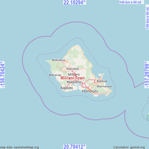
Mililani Town GPS coordinates[2]
21° 27' 0" North, 158° 0' 3.996" West
| Map corner | latitude | longitude |
|---|---|---|
| Upper-left | 22.10294°, | -158.70424° |
| Center: | 21.45°, | -158.00111° |
| Lower-right: | 20.79412°, | -157.29799° |
| Map W x H: | 145.5×145.5 km | = 90.4×90.4mi |
| max Lat: | 71.29058° ⇑99.5% North |
| Mililani Town: | 21.45° |
| min Lat: | ⇓0.5% South 19.06759° |
| min Long | Mililani Town | max Long |
| -171.73463° | -158.00111° | -66.98998° |
| W 0.4%⇐ | ⇒99.6% E |
Elevation
Elevation of Mililani Town is 207 m = 679 ft, and this is 87.8 m = 288 ft below average elevation for this country.
| Max E: |
3189 m = 10463 ft | 47.8% |
| Avg. | 294.8 m = 967 ft | |
| Mililani Town | 207 m = 679 ft | |
Min E: |
-60 m = -197 ft | 52.2% |
See also: United States elevation on elevation.city.
Geographical zone
Mililani Town is located in North Torrid zone (between Equator and Tropic of Cancer). Distance of this Northern Tropic circle is 220.9 km =137.3 mi to North.| Distance of | km | miles | from Mililani Town |
|---|---|---|---|
| North Pole | 7622 | 4736.1 | to North |
| Arctic Circle | 5016.2 | 3116.9 | to North |
| Tropic Cancer | 220.9 | 137.3 | to North |
| Equator | 2385 | 1482 | to South |


Nearby cities:
15 places around Mililani Town: (largest is in red/bold)
• Hālawa
11.4 km =7.1 mi,  133°
133°
• Hālawa Heights
12 km =7.5 mi, 131°
• Pearl City
6.4 km =4 mi,  155°
155°
• Royal Kunia
6.8 km =4.2 mi,  203°
203°
• Schofield Barracks
8.5 km =5.3 mi,  309°
309°
• Village Park
6.5 km =4 mi,  207°
207°
• Wahiawā
6.4 km =4 mi,  337°
337°
• Waimalu
7.8 km =4.8 mi, 130°
• Waipahu
7.1 km =4.4 mi,  186°
186°
• Waipio
3.5 km =2.2 mi,  176°
176°
• Waipi‘o Acres
2.1 km =1.3 mi,  322°
322°
• Whitmore Village
7.6 km =4.7 mi, 341°
• ‘Aiea
10.3 km =6.4 mi,  137°
137°
• ‘Ewa Gentry
12.6 km =7.8 mi, 193°
• ‘Ewa Villages
12.7 km =7.9 mi, 198°
Sources, notices
• [Note1] Compared only with cities in United States existing in our database
• [Src1] Map data: © OpenStreetMap contributors (CC-BY-SA)
• [Src2] Other city data from geonames.org with taken over terms of usage.
• [Src3] Geographical zone / Annual Mean Temperature by Robert A. Rohde @ Wikipedia
