Girdwood geodata
Girdwood (Alaska) is a populated place; located in United States in America/Anchorage (GMT-8) time zone. With population of 2,250 people, there are 11219 cities with bigger population in this country. Compared to other cities in United States, 99.7% of cities are located further ↓South; 99% of cities are located further →East and 82.3% of cities have higher elevation than Girdwood. Note1


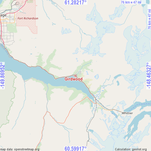
Girdwood GPS coordinates[2]
60° 56' 33" North, 149° 9' 59.004" West
| Map corner | latitude | longitude |
|---|---|---|
| Upper-left | 61.28217°, | -149.86952° |
| Center: | 60.9425°, | -149.16639° |
| Lower-right: | 60.59917°, | -148.46327° |
| Map W x H: | 75.9×75.9 km | = 47.2×47.2mi |
| max Lat: | 71.29058° ⇑0.3% North |
| Girdwood: | 60.9425° |
| min Lat: | ⇓99.7% South 19.06759° |
| min Long | Girdwood | max Long |
| -171.73463° | -149.16639° | -66.98998° |
| W 1%⇐ | ⇒99% E |
Elevation
Elevation of Girdwood is 37 m = 121 ft, and this is 257.8 m = 846 ft below average elevation for this country.
| Max E: |
3189 m = 10463 ft | 82.3% |
| Avg. | 294.8 m = 967 ft | |
| Girdwood | 37 m = 121 ft | |
Min E: |
-60 m = -197 ft | 17.7% |
See also: United States elevation on elevation.city.
Geographical zone
Girdwood is located in North temperate zone (between Tropic of Cancer and the Arctic Circle). Distance of this North polar circle is 625 km =388.4 mi to North.| Distance of | km | miles | from Girdwood |
|---|---|---|---|
| North Pole | 3230.9 | 2007.6 | to North |
| Arctic Circle | 625 | 388.4 | to North |
| Tropic Cancer | 4170.3 | 2591.3 | to South |
| Equator | 6776.2 | 4210.5 | to South |


Nearby cities:
15 places around Girdwood: (largest is in red/bold)
• Anchorage
50 km =31.1 mi,  307°
307°
• Big Lake
76.9 km =47.8 mi,  326°
326°
• Butte
67.1 km =41.7 mi,  6°
6°
• Eagle River
47.3 km =29.4 mi, 332°
• Elmendorf Air Force Base
43 km =26.7 mi,  324°
324°
• Farm Loop
77.4 km =48.1 mi,  0°
0°
• Gateway
70.2 km =43.6 mi,  356°
356°
• Knik River
59.1 km =36.7 mi, 13°
• Knik-Fairview
67.5 km =41.9 mi,  339°
339°
• Lakes
74.3 km =46.2 mi,  354°
354°
• Lazy Mountain
76.9 km =47.8 mi, 8°
• Palmer
73.1 km =45.4 mi, 2°
• Point MacKenzie
63.6 km =39.5 mi, 316°
• Tanaina
77.4 km =48.1 mi, 349°
• Wasilla
72.5 km =45 mi, 348°
Sources, notices
• [Note1] Compared only with cities in United States existing in our database
• [Src1] Map data: © OpenStreetMap contributors (CC-BY-SA)
• [Src2] Other city data from geonames.org with taken over terms of usage.
• [Src3] Geographical zone / Annual Mean Temperature by Robert A. Rohde @ Wikipedia
