Verde Village geodata
Verde Village (Arizona) is a populated place; located in United States in America/Phoenix (GMT-7) time zone. With population of 11,605 people, there are 3988 cities with bigger population in this country. Compared to other cities in United States, 76.8% of cities are located further ↑North; 87.5% of cities are located further →East and 93.8% of cities have lower elevation than Verde Village. Note1


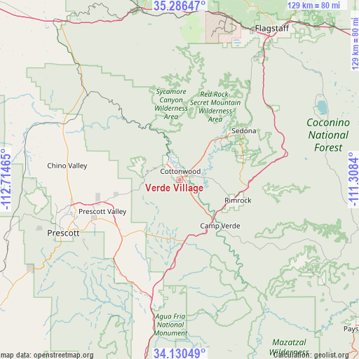
Verde Village GPS coordinates[2]
34° 42' 37.8" North, 112° 0' 41.472" West
| Map corner | latitude | longitude |
|---|---|---|
| Upper-left | 35.28647°, | -112.71465° |
| Center: | 34.7105°, | -112.01152° |
| Lower-right: | 34.13049°, | -111.3084° |
| Map W x H: | 128.5×128.5 km | = 79.8×79.8mi |
| max Lat: | 71.29058° ⇑76.8% North |
| Verde Village: | 34.7105° |
| min Lat: | ⇓23.2% South 19.06759° |
| min Long | Verde Village | max Long |
| -171.73463° | -112.01152° | -66.98998° |
| W 12.5%⇐ | ⇒87.5% E |
Elevation
Elevation of Verde Village is 1057 m = 3468 ft, and this is 762.2 m = 2501 ft above average elevation for this country.
| Max E: |
3189 m = 10463 ft | 6.2% |
| Verde Village | 1057 m 3468 ft | |
| Avg. | 294.8 m = 967 ft | |
Min E: |
-60 m = -197 ft | 93.8% |
See also: United States elevation on elevation.city.
Geographical zone
Verde Village is located in North temperate zone (between Tropic of Cancer and the Arctic Circle). Distance of this Northern Tropic circle is 1253.5 km =778.9 mi to South.| Distance of | km | miles | from Verde Village |
|---|---|---|---|
| North Pole | 6147.6 | 3819.9 | to North |
| Arctic Circle | 3541.7 | 2200.7 | to North |
| Tropic Cancer | 1253.5 | 778.9 | to South |
| Equator | 3859.4 | 2398.1 | to South |


Nearby cities:
15 places around Verde Village: (largest is in red/bold)
• Big Park
24 km =14.9 mi,  71°
71°
• Camp Verde
21.8 km =13.5 mi,  138°
138°
• Chino Valley
40.7 km =25.3 mi,  277°
277°
• Clarkdale
8 km =5 mi,  327°
327°
• Cornville
8.3 km =5.2 mi,  84°
84°
• Cottonwood
3.2 km =2 mi,  2°
2°
• Dewey-Humboldt
29.1 km =18.1 mi,  226°
226°
• Lake Montezuma
23.1 km =14.4 mi,  112°
112°
• Mayer
40.4 km =25.1 mi,  210°
210°
• Munds Park
42.8 km =26.6 mi,  52°
52°
• Prescott Valley
30 km =18.6 mi,  248°
248°
• Sedona
28.9 km =18 mi, 52°
• Spring Valley
42.8 km =26.6 mi,  198°
198°
• Village of Oak Creek (Big Park)
24.1 km =15 mi, 71°
• West Sedona
25.6 km =15.9 mi, 47°
Sources, notices
• [Note1] Compared only with cities in United States existing in our database
• [Src1] Map data: © OpenStreetMap contributors (CC-BY-SA)
• [Src2] Other city data from geonames.org with taken over terms of usage.
• [Src3] Geographical zone / Annual Mean Temperature by Robert A. Rohde @ Wikipedia
