Middleborough Center geodata
Middleborough Center (Massachusetts) is a populated place; located in United States in America/New_York (GMT-4) time zone. With population of 7,319 people, there are 5639 cities with bigger population in this country. Compared to other cities in United States, 74.7% of cities are located further ↓South; 97.8% of cities are located further ←West and 83.8% of cities have higher elevation than Middleborough Center. Note1
Administrative division(s):
- Level 1: Massachusetts
- Level 2: Plymouth County
- Level 3: Town of Middleborough
Current local time in Middleborough Center:
02:48 AM, WednesdayDifference from your time zone: hours


Middleborough Center GPS coordinates[2]
41° 53' 40.56" North, 70° 55' 34.248" West
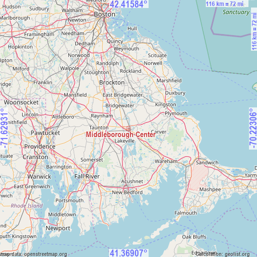
| Map corner | latitude | longitude |
|---|---|---|
| Upper-left | 42.41584°, | -71.62931° |
| Center: | 41.8946°, | -70.92618° |
| Lower-right: | 41.36907°, | -70.22306° |
| Map W x H: | 116.4×116.4 km | = 72.3×72.3mi |
| max Lat: | 71.29058° ⇑25.3% North |
| Middleborough Center: | 41.8946° |
| min Lat: | ⇓74.7% South 19.06759° |
| min Long | Middleborough C | max Long |
| -171.73463° | -70.92618° | -66.98998° |
| W 97.8%⇐ | ⇒2.2% E |
Elevation
Elevation of Middleborough Center is 32 m = 105 ft, and this is 262.8 m = 862 ft below average elevation for this country.
| Max E: |
3189 m = 10463 ft | 83.8% |
| Avg. | 294.8 m = 967 ft | |
| Middleborough Center | 32 m = 105 ft | |
Min E: |
-60 m = -197 ft | 16.2% |
See also: United States elevation on elevation.city.
Geographical zone
Middleborough Center is located in North temperate zone (between Tropic of Cancer and the Arctic Circle). Distance of this Northern Tropic circle is 2052.3 km =1275.2 mi to South.| Distance of | km | miles | from Middleborough Center |
|---|---|---|---|
| North Pole | 5348.8 | 3323.6 | to North |
| Arctic Circle | 2742.9 | 1704.4 | to North |
| Tropic Cancer | 2052.3 | 1275.2 | to South |
| Equator | 4658.2 | 2894.5 | to South |


Nearby cities:
15 places around Middleborough Center: (largest is in red/bold)
• Assonet
16.1 km =10 mi,  226°
226°
• Berkley
14.1 km =8.8 mi,  247°
247°
• Bridgewater
11.4 km =7.1 mi,  339°
339°
• Carver
13.6 km =8.5 mi,  95°
95°
• East Bridgewater
15.7 km =9.8 mi,  349°
349°
• Freetown
16.7 km =10.4 mi,  211°
211°
• Halifax
12 km =7.5 mi,  26°
26°
• Middleborough
1.3 km =0.8 mi, 97°
• North Lakeville
4.3 km =2.7 mi,  197°
197°
• Plympton
11.3 km =7 mi,  54°
54°
• Raynham
13.6 km =8.5 mi,  296°
296°
• Raynham Center
10.9 km =6.8 mi,  287°
287°
• Taunton
13.6 km =8.5 mi,  272°
272°
• West Bridgewater
15.4 km =9.6 mi,  333°
333°
• West Wareham
18 km =11.2 mi,  130°
130°
Sources, notices
• [Note1] Compared only with cities in United States existing in our database
• [Src1] Map data: © OpenStreetMap contributors (CC-BY-SA)
• [Src2] Other city data from geonames.org with taken over terms of usage.
• [Src3] Geographical zone / Annual Mean Temperature by Robert A. Rohde @ Wikipedia
