K. I. Sawyer Air Force Base geodata
K. I. Sawyer Air Force Base (Michigan) is a populated place; located in United States in America/Detroit (GMT-4) time zone. With population of 2,624 people, there are 10343 cities with bigger population in this country. Compared to other cities in United States, 95.5% of cities are located further ↓South; 50.5% of cities are located further →East and 80.8% of cities have lower elevation than K. I. Sawyer Air Force Base. Note1
Administrative division(s):
- Level 1: Michigan
- Level 2: Marquette County
- Level 3: Township of Forsyth
Current local time in K. I. Sawyer Air Force Base:
11:54 PM, SundayDifference from your time zone: hours


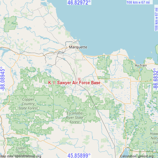
K. I. Sawyer Air Force Base GPS coordinates[2]
46° 20' 47.436" North, 87° 23' 10.752" West
| Map corner | latitude | longitude |
|---|---|---|
| Upper-left | 46.82972°, | -88.08945° |
| Center: | 46.34651°, | -87.38632° |
| Lower-right: | 45.85899°, | -86.6832° |
| Map W x H: | 107.9×107.9 km | = 67×67mi |
| max Lat: | 71.29058° ⇑4.5% North |
| K. I. Sawyer Air Force Base: | 46.34651° |
| min Lat: | ⇓95.5% South 19.06759° |
| min Long | K. I. Sawyer Ai | max Long |
| -171.73463° | -87.38632° | -66.98998° |
| W 49.5%⇐ | ⇒50.5% E |
Elevation
Elevation of K. I. Sawyer Air Force Base is 362 m = 1188 ft, and this is 67.2 m = 220 ft above average elevation for this country.
| Max E: |
3189 m = 10463 ft | 19.2% |
| K. I. Sawyer Air Force Base | 362 m 1188 ft | |
| Avg. | 294.8 m = 967 ft | |
Min E: |
-60 m = -197 ft | 80.8% |
See also: United States elevation on elevation.city.
Geographical zone
K. I. Sawyer Air Force Base is located in North temperate zone (between Tropic of Cancer and the Arctic Circle). Distance of this North polar circle is 2247.9 km =1396.8 mi to North.| Distance of | km | miles | from K. I. Sawyer Air Force Base |
|---|---|---|---|
| North Pole | 4853.8 | 3016 | to North |
| Arctic Circle | 2247.9 | 1396.8 | to North |
| Tropic Cancer | 2547.3 | 1582.8 | to South |
| Equator | 5153.2 | 3202 | to South |


Nearby cities:
15 places around K. I. Sawyer Air Force Base: (largest is in red/bold)
• Crystal Falls
78 km =48.5 mi,  249°
249°
• Escanaba
71.3 km =44.3 mi,  159°
159°
• Gladstone
61.7 km =38.3 mi,  152°
152°
• Gwinn
8.4 km =5.2 mi,  209°
209°
• Harvey
16.7 km =10.4 mi,  8°
8°
• Iron Mountain
78.6 km =48.8 mi,  221°
221°
• Ishpeming
26.7 km =16.6 mi,  306°
306°
• Marquette
21.9 km =13.6 mi,  358°
358°
• Munising
57 km =35.4 mi,  82°
82°
• Negaunee
24.2 km =15 mi, 314°
• Norway
73.9 km =45.9 mi, 212°
• Quinnesec
75.9 km =47.2 mi, 217°
• Republic
45.7 km =28.4 mi,  278°
278°
• Trowbridge Park
23.7 km =14.7 mi,  350°
350°
• West Ishpeming
28.5 km =17.7 mi,  302°
302°
Sources, notices
• [Note1] Compared only with cities in United States existing in our database
• [Src1] Map data: © OpenStreetMap contributors (CC-BY-SA)
• [Src2] Other city data from geonames.org with taken over terms of usage.
• [Src3] Geographical zone / Annual Mean Temperature by Robert A. Rohde @ Wikipedia
