Robin Glen-Indiantown geodata
Robin Glen-Indiantown (Michigan) is a populated place; located in United States in America/Detroit (GMT-4) time zone. With population of 722 people, there are 18480 cities with bigger population in this country. Compared to other cities in United States, 86.2% of cities are located further ↓South; 59.7% of cities are located further ←West and 55.5% of cities have higher elevation than Robin Glen-Indiantown. Note1
Administrative division(s):
- Level 1: Michigan
- Level 2: Saginaw County
- Level 3: Charter Township of Buena Vista


Robin Glen-Indiantown GPS coordinates[2]
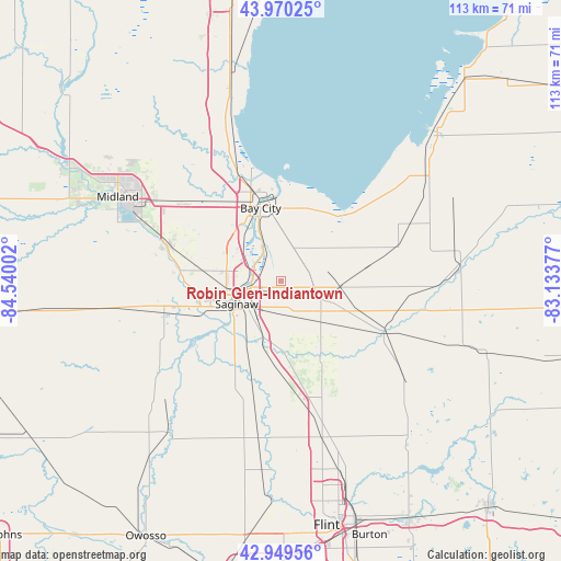
43° 27' 43.416" North, 83° 50' 12.804" West
| Map corner | latitude | longitude |
|---|---|---|
| Upper-left | 43.97025°, | -84.54002° |
| Center: | 43.46206°, | -83.83689° |
| Lower-right: | 42.94956°, | -83.13377° |
| Map W x H: | 113.5×113.5 km | = 70.5×70.5mi |
| max Lat: | 71.29058° ⇑13.8% North |
| Robin Glen-Indiantown: | 43.46206° |
| min Lat: | ⇓86.2% South 19.06759° |
| min Long | Robin Glen-Indi | max Long |
| -171.73463° | -83.83689° | -66.98998° |
| W 59.7%⇐ | ⇒40.3% E |
Elevation
Elevation of Robin Glen-Indiantown is 178 m = 584 ft, and this is 116.8 m = 383 ft below average elevation for this country.
| Max E: |
3189 m = 10463 ft | 55.5% |
| Avg. | 294.8 m = 967 ft | |
| Robin Glen-Indiantown | 178 m = 584 ft | |
Min E: |
-60 m = -197 ft | 44.5% |
See also: United States elevation on elevation.city.
Geographical zone
Robin Glen-Indiantown is located in North temperate zone (between Tropic of Cancer and the Arctic Circle). Distance of this Northern Tropic circle is 2226.6 km =1383.5 mi to South.| Distance of | km | miles | from Robin Glen-Indiantown |
|---|---|---|---|
| North Pole | 5174.5 | 3215.3 | to North |
| Arctic Circle | 2568.6 | 1596.1 | to North |
| Tropic Cancer | 2226.6 | 1383.5 | to South |
| Equator | 4832.5 | 3002.8 | to South |


Nearby cities:
15 places around Robin Glen-Indiantown: (largest is in red/bold)
• Auburn
24.5 km =15.2 mi,  309°
309°
• Bay City
15.3 km =9.5 mi,  344°
344°
• Birch Run
23.7 km =14.7 mi,  171°
171°
• Bridgeport
12 km =7.5 mi,  197°
197°
• Buena Vista
6.8 km =4.2 mi,  227°
227°
• Carrollton
7.5 km =4.7 mi,  267°
267°
• Essexville
17 km =10.6 mi,  358°
358°
• Frankenmuth
16.6 km =10.3 mi,  151°
151°
• Freeland
24.1 km =15 mi,  286°
286°
• Reese
11.4 km =7.1 mi,  96°
96°
• Saginaw
10.3 km =6.4 mi,  242°
242°
• Saginaw Township North
13.7 km =8.5 mi, 269°
• Shields
18.5 km =11.5 mi,  253°
253°
• Vassar
22.8 km =14.2 mi,  116°
116°
• Zilwaukee
6.9 km =4.3 mi,  283°
283°
Sources, notices
• [Note1] Compared only with cities in United States existing in our database
• [Src1] Map data: © OpenStreetMap contributors (CC-BY-SA)
• [Src2] Other city data from geonames.org with taken over terms of usage.
• [Src3] Geographical zone / Annual Mean Temperature by Robert A. Rohde @ Wikipedia
