Poplar-Cotton Center geodata
Poplar-Cotton Center (California) is a populated place; located in United States in America/Los_Angeles (GMT-7) time zone. With population of 2,470 people, there are 10699 cities with bigger population in this country. Compared to other cities in United States, 70.2% of cities are located further ↑North; 92% of cities are located further →East and 67.9% of cities have higher elevation than Poplar-Cotton Center. Note1
Current local time in Poplar-Cotton Center:
12:52 PM, WednesdayDifference from your time zone: hours


Poplar-Cotton Center GPS coordinates[2]
36° 3' 22.86" North, 119° 8' 57.084" West
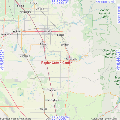
| Map corner | latitude | longitude |
|---|---|---|
| Upper-left | 36.62273°, | -119.85232° |
| Center: | 36.05635°, | -119.14919° |
| Lower-right: | 35.48587°, | -118.44607° |
| Map W x H: | 126.4×126.4 km | = 78.5×78.5mi |
| max Lat: | 71.29058° ⇑70.2% North |
| Poplar-Cotton Center: | 36.05635° |
| min Lat: | ⇓29.8% South 19.06759° |
| min Long | Poplar-Cotton C | max Long |
| -171.73463° | -119.14919° | -66.98998° |
| W 8%⇐ | ⇒92% E |
Elevation
Elevation of Poplar-Cotton Center is 113 m = 371 ft, and this is 181.8 m = 596 ft below average elevation for this country.
| Max E: |
3189 m = 10463 ft | 67.9% |
| Avg. | 294.8 m = 967 ft | |
| Poplar-Cotton Center | 113 m = 371 ft | |
Min E: |
-60 m = -197 ft | 32.1% |
See also: United States elevation on elevation.city.
Geographical zone
Poplar-Cotton Center is located in North temperate zone (between Tropic of Cancer and the Arctic Circle). Distance of this Northern Tropic circle is 1403.2 km =871.9 mi to South.| Distance of | km | miles | from Poplar-Cotton Center |
|---|---|---|---|
| North Pole | 5998 | 3727 | to North |
| Arctic Circle | 3392.1 | 2107.8 | to North |
| Tropic Cancer | 1403.2 | 871.9 | to South |
| Equator | 4009.1 | 2491.1 | to South |


Nearby cities:
15 places around Poplar-Cotton Center: (largest is in red/bold)
• Ducor
20.5 km =12.7 mi,  153°
153°
• Earlimart
22.1 km =13.7 mi,  210°
210°
• East Porterville
15.6 km =9.7 mi,  89°
89°
• East Tulare Villa
20.3 km =12.6 mi,  323°
323°
• Lindsay
17.2 km =10.7 mi,  18°
18°
• Matheny
22.2 km =13.8 mi,  304°
304°
• Pixley
16.1 km =10 mi,  232°
232°
• Plainview
9.9 km =6.2 mi,  7°
7°
• Porterville
11.9 km =7.4 mi, 85°
• Strathmore
12.7 km =7.9 mi,  38°
38°
• Terra Bella
14.1 km =8.8 mi,  137°
137°
• Teviston
18.3 km =11.4 mi,  219°
219°
• Tipton
14.6 km =9.1 mi,  271°
271°
• Tulare
24.5 km =15.2 mi,  313°
313°
• Woodville
6.1 km =3.8 mi, 312°
Sources, notices
• [Note1] Compared only with cities in United States existing in our database
• [Src1] Map data: © OpenStreetMap contributors (CC-BY-SA)
• [Src2] Other city data from geonames.org with taken over terms of usage.
• [Src3] Geographical zone / Annual Mean Temperature by Robert A. Rohde @ Wikipedia
