Mŭynoq geodata
Mŭynoq (Karakalpakstan) is a populated place; located in Uzbekistan in Asia/Samarkand (GMT+5) time zone. With population of 13,000 people, there are 104 cities with bigger population in this country. Compared to other cities in Uzbekistan, 99.4% of cities are located further ↓South; 97.7% of cities are located further →East and 100% of cities have higher elevation than Mŭynoq. Note1


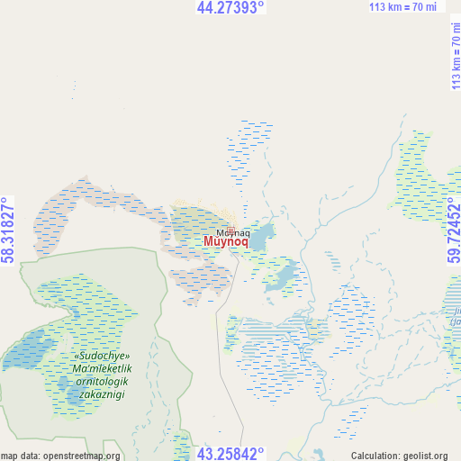
Mŭynoq GPS coordinates[2]
43° 46' 5.988" North, 59° 1' 17.004" East
| Map corner | latitude | longitude |
|---|---|---|
| Upper-left | 44.27393°, | 58.31827° |
| Center: | 43.76833°, | 59.02139° |
| Lower-right: | 43.25842°, | 59.72452° |
| Map W x H: | 112.9×112.9 km | = 70.2×70.2mi |
| max Lat: | 43.77877° ⇑0.6% North |
| Mŭynoq: | 43.76833° |
| min Lat: | ⇓99.4% South 37.22417° |
| min Long | Mŭynoq | max Long |
| 58.84596° | 59.02139° | 72.76177° |
| W 2.3%⇐ | ⇒97.7% E |
Elevation
Elevation of Mŭynoq is 50 m = 164 ft, and this is 383.8 m = 1259 ft below average elevation for this country.
| Max E: |
1464 m = 4803 ft | 100% |
| Avg. | 433.8 m = 1423 ft | |
| Mŭynoq | 50 m = 164 ft | |
Min E: |
50 m = 164 ft | 0% |
See also: Uzbekistan elevation on elevation.city.
Geographical zone
Mŭynoq is located in North temperate zone (between Tropic of Cancer and the Arctic Circle). Distance of this Northern Tropic circle is 2260.7 km =1404.7 mi to South.| Distance of | km | miles | from Mŭynoq |
|---|---|---|---|
| North Pole | 5140.5 | 3194.2 | to North |
| Arctic Circle | 2534.6 | 1574.9 | to North |
| Tropic Cancer | 2260.7 | 1404.7 | to South |
| Equator | 4866.6 | 3024 | to South |


Nearby cities:
15 places around Mŭynoq: (largest is in red/bold)
• Chimboy Shahri
111.7 km =69.4 mi,  146°
146°
• Kegeyli Shahar
120 km =74.6 mi,  156°
156°
• Khŭjayli
156.2 km =97.1 mi,  166°
166°
• Mang‘it Shahri
201.7 km =125.3 mi, 155°
• Mo‘ynoq Shahri
1.4 km =0.9 mi,  31°
31°
• Nukus
153.9 km =95.6 mi, 161°
• Oltinko‘l
78.4 km =48.7 mi,  186°
186°
• Oqmang‘it
136.5 km =84.8 mi, 162°
• Qanliko‘l
103.3 km =64.2 mi,  180°
180°
• Qorao‘zak
115.6 km =71.8 mi,  135°
135°
• Qozonketkan
87.8 km =54.6 mi, 161°
• Qo‘ng‘irot Shahri
80.9 km =50.3 mi, 190°
• Shumanay Shahri
126.3 km =78.5 mi, 183°
• Taxtako‘pir
133.3 km =82.8 mi,  129°
129°
• Xo‘jayli Shahri
155 km =96.3 mi, 167°
Sources, notices
• [Note1] Compared only with cities in Uzbekistan existing in our database
• [Src1] Map data: © OpenStreetMap contributors (CC-BY-SA)
• [Src2] Other city data from geonames.org with taken over terms of usage.
• [Src3] Geographical zone / Annual Mean Temperature by Robert A. Rohde @ Wikipedia
