Qanliko‘l geodata
Qanliko‘l (Karakalpakstan) is a seat of a second-order administrative division; located in Uzbekistan in Asia/Samarkand (GMT+5) time zone. In our database, there are 114 cities with bigger population. Compared to other cities in Uzbekistan, 95.4% of cities are located further ↓South; 98.3% of cities are located further →East and 95.4% of cities have higher elevation than Qanliko‘l. Note1


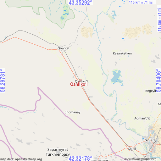
Qanliko‘l GPS coordinates[2]
42° 50' 22.2" North, 59° 0' 3.348" East
| Map corner | latitude | longitude |
|---|---|---|
| Upper-left | 43.35292°, | 58.29781° |
| Center: | 42.8395°, | 59.00093° |
| Lower-right: | 42.32178°, | 59.70406° |
| Map W x H: | 114.7×114.7 km | = 71.3×71.3mi |
| max Lat: | 43.77877° ⇑4.6% North |
| Qanliko‘l: | 42.8395° |
| min Lat: | ⇓95.4% South 37.22417° |
| min Long | Qanliko‘l | max Long |
| 58.84596° | 59.00093° | 72.76177° |
| W 1.7%⇐ | ⇒98.3% E |
Elevation
Elevation of Qanliko‘l is 68 m = 223 ft, and this is 365.8 m = 1200 ft below average elevation for this country.
| Max E: |
1464 m = 4803 ft | 95.4% |
| Avg. | 433.8 m = 1423 ft | |
| Qanliko‘l | 68 m = 223 ft | |
Min E: |
50 m = 164 ft | 4.6% |
See also: Uzbekistan elevation on elevation.city.
Geographical zone
Qanliko‘l is located in North temperate zone (between Tropic of Cancer and the Arctic Circle). Distance of this Northern Tropic circle is 2157.4 km =1340.5 mi to South.| Distance of | km | miles | from Qanliko‘l |
|---|---|---|---|
| North Pole | 5243.8 | 3258.3 | to North |
| Arctic Circle | 2637.9 | 1639.1 | to North |
| Tropic Cancer | 2157.4 | 1340.5 | to South |
| Equator | 4763.3 | 2959.8 | to South |


Nearby cities:
15 places around Qanliko‘l: (largest is in red/bold)
• Chimboy Shahri
64.4 km =40 mi,  81°
81°
• Kegeyli Shahar
50 km =31.1 mi,  98°
98°
• Khŭjayli
61.6 km =38.3 mi,  142°
142°
• Mang‘it Shahri
118.1 km =73.4 mi,  132°
132°
• Mo‘ynoq Shahri
104.5 km =64.9 mi,  1°
1°
• Mŭynoq
103.3 km =64.2 mi, 0°
• Nukus
65.8 km =40.9 mi, 130°
• Oltinko‘l
26.7 km =16.6 mi,  342°
342°
• Oqmang‘it
51.1 km =31.8 mi,  121°
121°
• Qorao‘zak
85.2 km =52.9 mi, 76°
• Qozonketkan
35.7 km =22.2 mi,  55°
55°
• Qo‘ng‘irot Shahri
26.8 km =16.7 mi,  331°
331°
• Shumanay Shahri
23.5 km =14.6 mi,  194°
194°
• Taxtako‘pir
107.6 km =66.9 mi, 79°
• Xo‘jayli Shahri
60.1 km =37.3 mi, 142°
Sources, notices
• [Note1] Compared only with cities in Uzbekistan existing in our database
• [Src1] Map data: © OpenStreetMap contributors (CC-BY-SA)
• [Src2] Other city data from geonames.org with taken over terms of usage.
• [Src3] Geographical zone / Annual Mean Temperature by Robert A. Rohde @ Wikipedia
