Qorao‘zak geodata
Qorao‘zak (Karakalpakstan) is a seat of a second-order administrative division; located in Uzbekistan in Asia/Samarkand (GMT+5) time zone. In our database, there are 114 cities with bigger population. Compared to other cities in Uzbekistan, 97.7% of cities are located further ↓South; 92.5% of cities are located further →East and 98.9% of cities have higher elevation than Qorao‘zak. Note1


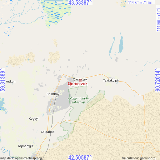
Qorao‘zak GPS coordinates[2]
43° 1' 19.452" North, 60° 1' 1.236" East
| Map corner | latitude | longitude |
|---|---|---|
| Upper-left | 43.53397°, | 59.31389° |
| Center: | 43.02207°, | 60.01701° |
| Lower-right: | 42.50587°, | 60.72014° |
| Map W x H: | 114.3×114.3 km | = 71×71mi |
| max Lat: | 43.77877° ⇑2.3% North |
| Qorao‘zak: | 43.02207° |
| min Lat: | ⇓97.7% South 37.22417° |
| min Long | Qorao‘zak | max Long |
| 58.84596° | 60.01701° | 72.76177° |
| W 7.5%⇐ | ⇒92.5% E |
Elevation
Elevation of Qorao‘zak is 61 m = 200 ft, and this is 372.8 m = 1223 ft below average elevation for this country.
| Max E: |
1464 m = 4803 ft | 98.9% |
| Avg. | 433.8 m = 1423 ft | |
| Qorao‘zak | 61 m = 200 ft | |
Min E: |
50 m = 164 ft | 1.1% |
See also: Uzbekistan elevation on elevation.city.
Geographical zone
Qorao‘zak is located in North temperate zone (between Tropic of Cancer and the Arctic Circle). Distance of this Northern Tropic circle is 2177.7 km =1353.2 mi to South.| Distance of | km | miles | from Qorao‘zak |
|---|---|---|---|
| North Pole | 5223.5 | 3245.7 | to North |
| Arctic Circle | 2617.6 | 1626.5 | to North |
| Tropic Cancer | 2177.7 | 1353.2 | to South |
| Equator | 4783.6 | 2972.4 | to South |


Nearby cities:
15 places around Qorao‘zak: (largest is in red/bold)
• Chimboy Shahri
21.7 km =13.5 mi,  241°
241°
• Kegeyli Shahar
43.1 km =26.8 mi,  230°
230°
• Khŭjayli
82.8 km =51.4 mi,  213°
213°
• Manghit
100.9 km =62.7 mi,  178°
178°
• Mang‘it Shahri
100.1 km =62.2 mi, 177°
• Mŭynoq
115.6 km =71.8 mi,  315°
315°
• Nukus
71.5 km =44.4 mi, 207°
• Oltinko‘l
90.6 km =56.3 mi,  273°
273°
• Oqmang‘it
61.3 km =38.1 mi,  219°
219°
• Qanliko‘l
85.2 km =52.9 mi,  256°
256°
• Qozonketkan
53.1 km =33 mi, 269°
• Qo‘ng‘irot Shahri
95.2 km =59.2 mi, 272°
• Shumanay Shahri
98.5 km =61.2 mi, 244°
• Taxtako‘pir
23.1 km =14.4 mi,  92°
92°
• Xo‘jayli Shahri
82.6 km =51.3 mi, 214°
Sources, notices
• [Note1] Compared only with cities in Uzbekistan existing in our database
• [Src1] Map data: © OpenStreetMap contributors (CC-BY-SA)
• [Src2] Other city data from geonames.org with taken over terms of usage.
• [Src3] Geographical zone / Annual Mean Temperature by Robert A. Rohde @ Wikipedia
