Kosonsoy geodata
Kosonsoy (Namangan) is a seat of a second-order administrative division; located in Uzbekistan in Asia/Tashkent (GMT+5) time zone. With population of 43,684 people, there are 34 cities with bigger population in this country. Compared to other cities in Uzbekistan, 77.6% of cities are located further ↓South; 80.5% of cities are located further ←West and 93.7% of cities have lower elevation than Kosonsoy. Note1


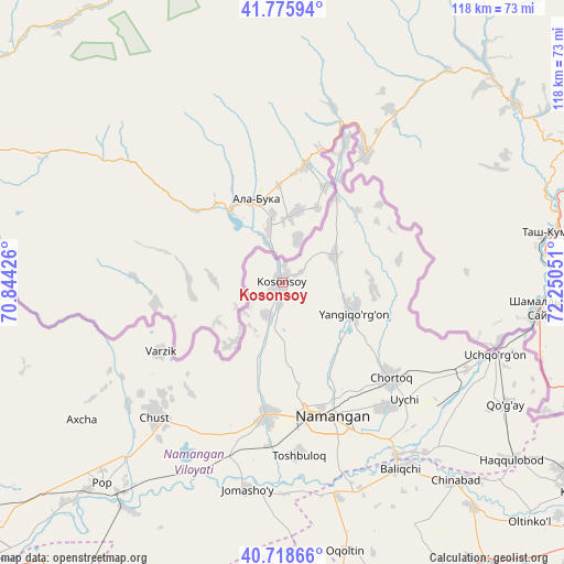
Kosonsoy GPS coordinates[2]
41° 14' 57.984" North, 71° 32' 50.568" East
| Map corner | latitude | longitude |
|---|---|---|
| Upper-left | 41.77594°, | 70.84426° |
| Center: | 41.24944°, | 71.54738° |
| Lower-right: | 40.71866°, | 72.25051° |
| Map W x H: | 117.6×117.6 km | = 73.1×73.1mi |
| max Lat: | 43.77877° ⇑22.4% North |
| Kosonsoy: | 41.24944° |
| min Lat: | ⇓77.6% South 37.22417° |
| min Long | Kosonsoy | max Long |
| 58.84596° | 71.54738° | 72.76177° |
| W 80.5%⇐ | ⇒19.5% E |
Elevation
Elevation of Kosonsoy is 892 m = 2927 ft, and this is 458.2 m = 1503 ft above average elevation for this country.
| Max E: |
1464 m = 4803 ft | 6.3% |
| Kosonsoy | 892 m 2927 ft | |
| Avg. | 433.8 m = 1423 ft | |
Min E: |
50 m = 164 ft | 93.7% |
See also: Kosonsoy elevation on elevation.city.
Geographical zone
Kosonsoy is located in North temperate zone (between Tropic of Cancer and the Arctic Circle). Distance of this Northern Tropic circle is 1980.6 km =1230.7 mi to South.| Distance of | km | miles | from Kosonsoy |
|---|---|---|---|
| North Pole | 5420.6 | 3368.2 | to North |
| Arctic Circle | 2814.7 | 1749 | to North |
| Tropic Cancer | 1980.6 | 1230.7 | to South |
| Equator | 4586.5 | 2849.9 | to South |


Nearby cities:
15 places around Kosonsoy: (largest is in red/bold)
• Baliqchi
45.8 km =28.5 mi,  146°
146°
• Chortoq
30.6 km =19 mi,  130°
130°
• Chortoq Shahri
29.7 km =18.5 mi, 130°
• Chust
37.7 km =23.4 mi,  223°
223°
• Kosonsoy Shahri
1.6 km =1 mi,  344°
344°
• Namangan
29.8 km =18.5 mi,  159°
159°
• Oqoltin
57.4 km =35.7 mi,  167°
167°
• Pop
55.7 km =34.6 mi, 221°
• Pop Shahri
55.8 km =34.7 mi, 221°
• Toshbuloq
37.1 km =23.1 mi,  176°
176°
• To‘rqao‘rg‘on
27.9 km =17.3 mi,  186°
186°
• Tŭragŭrghon Shahri
27.5 km =17.1 mi, 186°
• Uchqŭrghon Shahri
47 km =29.2 mi,  108°
108°
• Uychi
36.6 km =22.7 mi,  120°
120°
• Yangiqo‘rg‘on
16 km =9.9 mi, 112°
Sources, notices
• [Note1] Compared only with cities in Uzbekistan existing in our database
• [Src1] Map data: © OpenStreetMap contributors (CC-BY-SA)
• [Src2] Other city data from geonames.org with taken over terms of usage.
• [Src3] Geographical zone / Annual Mean Temperature by Robert A. Rohde @ Wikipedia
