Beruniy geodata
Beruniy (Karakalpakstan) is a populated place; located in Uzbekistan in Asia/Samarkand (GMT+5) time zone. With population of 50,929 people, there are 29 cities with bigger population in this country. Compared to other cities in Uzbekistan, 87.4% of cities are located further ↓South; 87.4% of cities are located further →East and 86.8% of cities have higher elevation than Beruniy. Note1


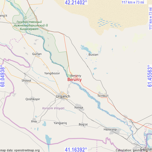
Beruniy GPS coordinates[2]
41° 41' 27.996" North, 60° 45' 9" East
| Map corner | latitude | longitude |
|---|---|---|
| Upper-left | 42.21402°, | 60.04938° |
| Center: | 41.69111°, | 60.7525° |
| Lower-right: | 41.16392°, | 61.45563° |
| Map W x H: | 116.8×116.8 km | = 72.6×72.6mi |
| max Lat: | 43.77877° ⇑12.6% North |
| Beruniy: | 41.69111° |
| min Lat: | ⇓87.4% South 37.22417° |
| min Long | Beruniy | max Long |
| 58.84596° | 60.7525° | 72.76177° |
| W 12.6%⇐ | ⇒87.4% E |
Elevation
Elevation of Beruniy is 101 m = 331 ft, and this is 332.8 m = 1092 ft below average elevation for this country.
| Max E: |
1464 m = 4803 ft | 86.8% |
| Avg. | 433.8 m = 1423 ft | |
| Beruniy | 101 m = 331 ft | |
Min E: |
50 m = 164 ft | 13.2% |
See also: Beruniy elevation on elevation.city.
Geographical zone
Beruniy is located in North temperate zone (between Tropic of Cancer and the Arctic Circle). Distance of this Northern Tropic circle is 2029.7 km =1261.2 mi to South.| Distance of | km | miles | from Beruniy |
|---|---|---|---|
| North Pole | 5371.4 | 3337.6 | to North |
| Arctic Circle | 2765.6 | 1718.5 | to North |
| Tropic Cancer | 2029.7 | 1261.2 | to South |
| Equator | 4635.6 | 2880.4 | to South |


Nearby cities:
15 places around Beruniy: (largest is in red/bold)
• Beruniy Shahri
0.9 km =0.6 mi,  13°
13°
• Bo‘ston Shahri
23.6 km =14.7 mi,  43°
43°
• Gurlan
34.4 km =21.4 mi,  299°
299°
• Hazorasp
49.2 km =30.6 mi,  147°
147°
• Khiwa
47.5 km =29.5 mi,  222°
222°
• Khŭjayli
132.7 km =82.5 mi,  306°
306°
• Manghit
74.3 km =46.2 mi, 309°
• Mang‘it Shahri
74.5 km =46.3 mi, 310°
• Novyy Turtkul’
27 km =16.8 mi,  125°
125°
• Nukus
126.7 km =78.7 mi, 311°
• Qŭshkŭpir
38 km =23.6 mi,  242°
242°
• Showot
37.6 km =23.4 mi,  264°
264°
• To‘rtko‘l Shahri
25.3 km =15.7 mi, 125°
• Urganch
18.6 km =11.6 mi,  212°
212°
• Xo‘jayli Shahri
134.2 km =83.4 mi, 306°
Sources, notices
• [Note1] Compared only with cities in Uzbekistan existing in our database
• [Src1] Map data: © OpenStreetMap contributors (CC-BY-SA)
• [Src2] Other city data from geonames.org with taken over terms of usage.
• [Src3] Geographical zone / Annual Mean Temperature by Robert A. Rohde @ Wikipedia
