To‘rtko‘l Shahri geodata
To‘rtko‘l Shahri (Karakalpakstan) is a seat of a second-order administrative division; located in Uzbekistan in Asia/Samarkand (GMT+5) time zone. In our database, there are 114 cities with bigger population. Compared to other cities in Uzbekistan, 85.6% of cities are located further ↓South; 85.6% of cities are located further →East and 85.1% of cities have higher elevation than To‘rtko‘l Shahri. Note1


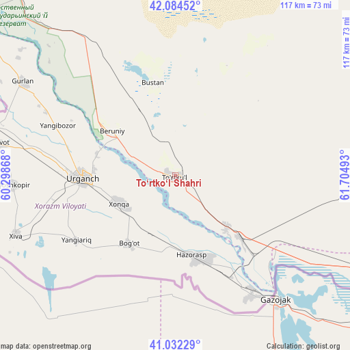
To‘rtko‘l Shahri GPS coordinates[2]
41° 33' 37.98" North, 61° 0' 6.48" East
| Map corner | latitude | longitude |
|---|---|---|
| Upper-left | 42.08452°, | 60.29868° |
| Center: | 41.56055°, | 61.0018° |
| Lower-right: | 41.03229°, | 61.70493° |
| Map W x H: | 117×117 km | = 72.7×72.7mi |
| max Lat: | 43.77877° ⇑14.4% North |
| To‘rtko‘l Shahri: | 41.56055° |
| min Lat: | ⇓85.6% South 37.22417° |
| min Long | To‘rtko‘l S | max Long |
| 58.84596° | 61.0018° | 72.76177° |
| W 14.4%⇐ | ⇒85.6% E |
Elevation
Elevation of To‘rtko‘l Shahri is 108 m = 354 ft, and this is 325.8 m = 1069 ft below average elevation for this country.
| Max E: |
1464 m = 4803 ft | 85.1% |
| Avg. | 433.8 m = 1423 ft | |
| To‘rtko‘l Shahri | 108 m = 354 ft | |
Min E: |
50 m = 164 ft | 14.9% |
See also: Uzbekistan elevation on elevation.city.
Geographical zone
To‘rtko‘l Shahri is located in North temperate zone (between Tropic of Cancer and the Arctic Circle). Distance of this Northern Tropic circle is 2015.2 km =1252.2 mi to South.| Distance of | km | miles | from To‘rtko‘l Shahri |
|---|---|---|---|
| North Pole | 5386 | 3346.7 | to North |
| Arctic Circle | 2780.1 | 1727.5 | to North |
| Tropic Cancer | 2015.2 | 1252.2 | to South |
| Equator | 4621.1 | 2871.4 | to South |


Nearby cities:
15 places around To‘rtko‘l Shahri: (largest is in red/bold)
• Beruniy
25.3 km =15.7 mi,  305°
305°
• Beruniy Shahri
25.6 km =15.9 mi, 306°
• Bo‘ston Shahri
32.1 km =19.9 mi,  351°
351°
• Gurlan
59.7 km =37.1 mi,  301°
301°
• Hazorasp
27.5 km =17.1 mi,  167°
167°
• Khiwa
56.9 km =35.4 mi,  249°
249°
• Khŭjayli
158 km =98.2 mi, 306°
• Manghit
99.5 km =61.8 mi, 308°
• Mang‘it Shahri
99.7 km =62 mi, 308°
• Novyy Turtkul’
1.7 km =1.1 mi,  133°
133°
• Nukus
151.9 km =94.4 mi, 310°
• Qŭshkŭpir
54.7 km =34 mi,  267°
267°
• Showot
59.1 km =36.7 mi,  280°
280°
• Urganch
30.7 km =19.1 mi, 267°
• Xo‘jayli Shahri
159.5 km =99.1 mi, 306°
Sources, notices
• [Note1] Compared only with cities in Uzbekistan existing in our database
• [Src1] Map data: © OpenStreetMap contributors (CC-BY-SA)
• [Src2] Other city data from geonames.org with taken over terms of usage.
• [Src3] Geographical zone / Annual Mean Temperature by Robert A. Rohde @ Wikipedia
