San Timoteo geodata
San Timoteo (Zulia) is a seat of a second-order administrative division; located in Venezuela in America/Caracas (GMT-4) time zone. In our database, there are 108 cities with bigger population. Compared to other cities in Venezuela, 54.7% of cities are located further ↓South; 80.9% of cities are located further →East and 99.2% of cities have higher elevation than San Timoteo. Note1


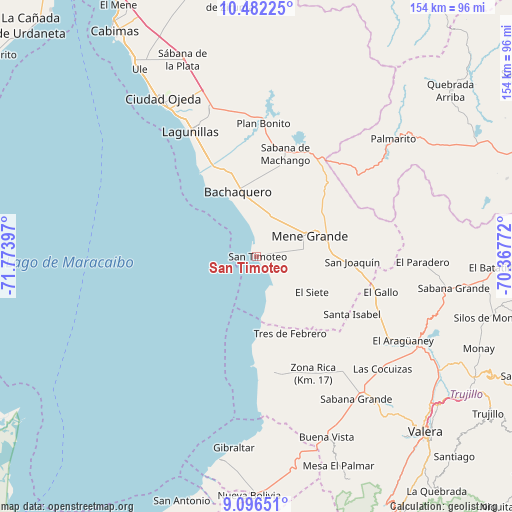
San Timoteo GPS coordinates[2]
9° 47' 24.36" North, 71° 4' 15.024" West
| Map corner | latitude | longitude |
|---|---|---|
| Upper-left | 10.48225°, | -71.77397° |
| Center: | 9.7901°, | -71.07084° |
| Lower-right: | 9.09651°, | -70.36772° |
| Map W x H: | 154.1×154.1 km | = 95.8×95.8mi |
| max Lat: | 11.94788° ⇑45.3% North |
| San Timoteo: | 9.7901° |
| min Lat: | ⇓54.7% South 1.92027° |
| min Long | San Timoteo | max Long |
| -72.55212° | -71.07084° | -60.99778° |
| W 19.1%⇐ | ⇒80.9% E |
Elevation
Elevation of San Timoteo is 1 m = 3 ft, and this is 379.6 m = 1245 ft below average elevation for this country.
| Max E: |
2986 m = 9797 ft | 99.2% |
| Avg. | 380.6 m = 1249 ft | |
| San Timoteo | 1 m = 3 ft | |
Min E: |
-4 m = -13 ft | 0.8% |
See also: Venezuela elevation on elevation.city.
Geographical zone
San Timoteo is located in North Torrid zone (between Equator and Tropic of Cancer). Distance of Equator is 1088.6 km =676.4 mi to South.| Distance of | km | miles | from San Timoteo |
|---|---|---|---|
| North Pole | 8918.5 | 5541.7 | to North |
| Arctic Circle | 6312.6 | 3922.5 | to North |
| Tropic Cancer | 1517.4 | 942.9 | to North |
| Equator | 1088.6 | 676.4 | to South |


Nearby cities:
15 places around San Timoteo: (largest is in red/bold)
• Arapuey
60.4 km =37.5 mi,  167°
167°
• Bachaquero
20 km =12.4 mi,  343°
343°
• Betijoque
58.7 km =36.5 mi,  140°
140°
• Bobures
62 km =38.5 mi,  190°
190°
• Ciudad Ojeda
53 km =32.9 mi,  329°
329°
• El Corozo
36.9 km =22.9 mi,  4°
4°
• El Dividive
50.8 km =31.6 mi,  133°
133°
• El Paradero
49.9 km =31 mi,  92°
92°
• La Plata
62.9 km =39.1 mi, 339°
• Lagunillas
43.1 km =26.8 mi, 331°
• Sabana Grande
52.5 km =32.6 mi,  145°
145°
• Sabana de Mendoza
51.1 km =31.8 mi, 140°
• Santa Apolonia
36 km =22.4 mi, 169°
• Santa Isabel
33.7 km =20.9 mi,  121°
121°
• Tía Juana
61.2 km =38 mi, 328°
Sources, notices
• [Note1] Compared only with cities in Venezuela existing in our database
• [Src1] Map data: © OpenStreetMap contributors (CC-BY-SA)
• [Src2] Other city data from geonames.org with taken over terms of usage.
• [Src3] Geographical zone / Annual Mean Temperature by Robert A. Rohde @ Wikipedia
