La Plata geodata
La Plata (Zulia) is a seat of a third-order administrative division; located in Venezuela in America/Caracas (GMT-4) time zone. In our database, there are 108 cities with bigger population. Compared to other cities in Venezuela, 75.3% of cities are located further ↓South; 83.7% of cities are located further →East and 80.7% of cities have higher elevation than La Plata. Note1


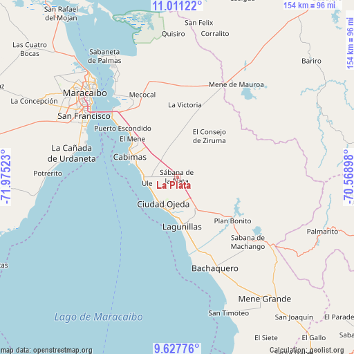
La Plata GPS coordinates[2]
10° 19' 12.9" North, 71° 16' 19.56" West
| Map corner | latitude | longitude |
|---|---|---|
| Upper-left | 11.01122°, | -71.97523° |
| Center: | 10.32025°, | -71.2721° |
| Lower-right: | 9.62776°, | -70.56898° |
| Map W x H: | 153.8×153.8 km | = 95.6×95.6mi |
| max Lat: | 11.94788° ⇑24.7% North |
| La Plata: | 10.32025° |
| min Lat: | ⇓75.3% South 1.92027° |
| min Long | La Plata | max Long |
| -72.55212° | -71.2721° | -60.99778° |
| W 16.3%⇐ | ⇒83.7% E |
Elevation
Elevation of La Plata is 48 m = 157 ft, and this is 332.6 m = 1091 ft below average elevation for this country.
| Max E: |
2986 m = 9797 ft | 80.7% |
| Avg. | 380.6 m = 1249 ft | |
| La Plata | 48 m = 157 ft | |
Min E: |
-4 m = -13 ft | 19.3% |
See also: Venezuela elevation on elevation.city.
Geographical zone
La Plata is located in North Torrid zone (between Equator and Tropic of Cancer). Distance of Equator is 1147.5 km =713 mi to South.| Distance of | km | miles | from La Plata |
|---|---|---|---|
| North Pole | 8859.6 | 5505.1 | to North |
| Arctic Circle | 6253.7 | 3885.9 | to North |
| Tropic Cancer | 1458.4 | 906.2 | to North |
| Equator | 1147.5 | 713 | to South |


Nearby cities:
15 places around La Plata: (largest is in red/bold)
• Bachaquero
43 km =26.7 mi,  157°
157°
• Cabimas
21.5 km =13.4 mi,  294°
294°
• Ciudad Ojeda
14 km =8.7 mi,  199°
199°
• Concepción
46.7 km =29 mi,  282°
282°
• Concepción
75.9 km =47.2 mi,  314°
314°
• El Corozo
33.4 km =20.8 mi,  131°
131°
• La Concepción
70.3 km =43.7 mi,  298°
298°
• Lagunillas
21.2 km =13.2 mi,  176°
176°
• Los Puertos de Altagracia
51.7 km =32.1 mi,  328°
328°
• Maracaibo
53.6 km =33.3 mi,  315°
315°
• Mene de Mauroa
47.7 km =29.6 mi,  32°
32°
• San Francisco
53.9 km =33.5 mi, 298°
• San Timoteo
62.9 km =39.1 mi, 159°
• Santa Rita
35.5 km =22.1 mi, 312°
• Tía Juana
12.1 km =7.5 mi,  235°
235°
Sources, notices
• [Note1] Compared only with cities in Venezuela existing in our database
• [Src1] Map data: © OpenStreetMap contributors (CC-BY-SA)
• [Src2] Other city data from geonames.org with taken over terms of usage.
• [Src3] Geographical zone / Annual Mean Temperature by Robert A. Rohde @ Wikipedia
