Mene de Mauroa geodata
Mene de Mauroa (Falcón) is a seat of a second-order administrative division; located in Venezuela in America/Caracas (GMT-4) time zone. In our database, there are 108 cities with bigger population. Compared to other cities in Venezuela, 89.8% of cities are located further ↓South; 80.2% of cities are located further →East and 60.6% of cities have higher elevation than Mene de Mauroa. Note1


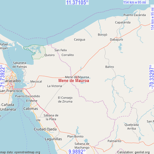
Mene de Mauroa GPS coordinates[2]
10° 40' 51.276" North, 71° 2' 9.924" West
| Map corner | latitude | longitude |
|---|---|---|
| Upper-left | 11.37105°, | -71.73922° |
| Center: | 10.68091°, | -71.03609° |
| Lower-right: | 9.9892°, | -70.33297° |
| Map W x H: | 153.6×153.7 km | = 95.4×95.5mi |
| max Lat: | 11.94788° ⇑10.2% North |
| Mene de Mauroa: | 10.68091° |
| min Lat: | ⇓89.8% South 1.92027° |
| min Long | Mene de Mauroa | max Long |
| -72.55212° | -71.03609° | -60.99778° |
| W 19.8%⇐ | ⇒80.2% E |
Elevation
Elevation of Mene de Mauroa is 131 m = 430 ft, and this is 249.6 m = 819 ft below average elevation for this country.
| Max E: |
2986 m = 9797 ft | 60.6% |
| Avg. | 380.6 m = 1249 ft | |
| Mene de Mauroa | 131 m = 430 ft | |
Min E: |
-4 m = -13 ft | 39.4% |
See also: Venezuela elevation on elevation.city.
Geographical zone
Mene de Mauroa is located in North Torrid zone (between Equator and Tropic of Cancer). Distance of Equator is 1187.6 km =737.9 mi to South.| Distance of | km | miles | from Mene de Mauroa |
|---|---|---|---|
| North Pole | 8819.5 | 5480.2 | to North |
| Arctic Circle | 6213.6 | 3861 | to North |
| Tropic Cancer | 1418.3 | 881.3 | to North |
| Equator | 1187.6 | 737.9 | to South |


Nearby cities:
15 places around Mene de Mauroa: (largest is in red/bold)
• Bachaquero
80.5 km =50 mi,  186°
186°
• Cabimas
55.2 km =34.3 mi,  235°
235°
• Canape Capatárida
71.3 km =44.3 mi,  39°
39°
• Ciudad Ojeda
61.4 km =38.2 mi,  209°
209°
• Concepción
77.4 km =48.1 mi,  247°
247°
• Dabajuro
54.6 km =33.9 mi,  45°
45°
• El Corozo
62.3 km =38.7 mi,  180°
180°
• El Toro
73.5 km =45.7 mi,  294°
294°
• La Plata
47.7 km =29.6 mi, 212°
• Lagunillas
65.9 km =40.9 mi,  201°
201°
• Los Puertos de Altagracia
53.2 km =33.1 mi,  274°
274°
• Maracaibo
63 km =39.1 mi, 268°
• San Francisco
74.3 km =46.2 mi,  259°
259°
• Santa Rita
54.3 km =33.7 mi, 252°
• Tía Juana
59 km =36.7 mi,  217°
217°
Sources, notices
• [Note1] Compared only with cities in Venezuela existing in our database
• [Src1] Map data: © OpenStreetMap contributors (CC-BY-SA)
• [Src2] Other city data from geonames.org with taken over terms of usage.
• [Src3] Geographical zone / Annual Mean Temperature by Robert A. Rohde @ Wikipedia
